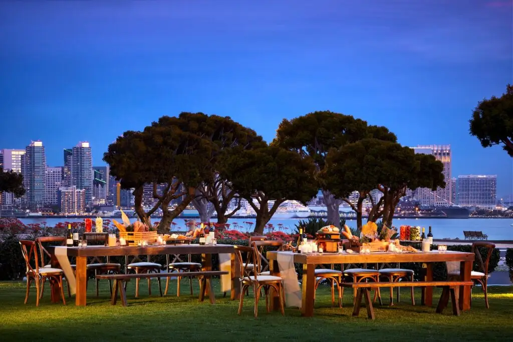
It’s difficult to walk down Beta Street in San Diego’s Southcrest neighborhood, the area that received the brunt of the flooding caused by Monday’s winter storm. The ground is slick with mud and I have to watch where I step; the street has become a disaster zone.
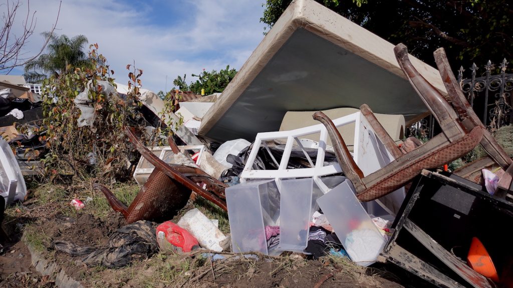
Every single house I pass has water-damaged belongings outside. Totalled vehicles filled with mud and debris line the road on both sides.
“[We lost] everything in our bedrooms, kitchen, bathroom. TVs, computers, clothes. Everything. The only thing we have left is the urge to keep going,” says Óscar Pacheco, a resident who has lived on this street for 24 years.
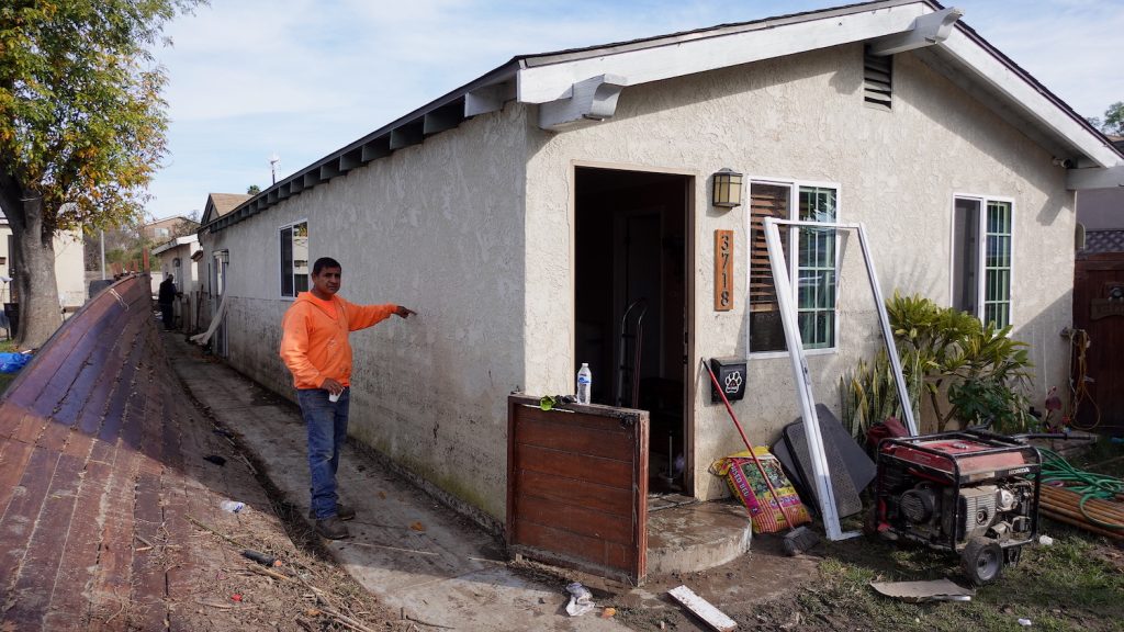
Pacheco shows me the shoulder-height watermark on the outside of his house and leads me inside, where the only thing left untouched is a TV in his bedroom. “That one was attached to the wall, high up,” he says.
Southcrest resident Óscar Pacheco points to how high water levels rose after Monday’s rainfall. | Photo Credit: María José Durán
Beta Street lays parallel to the South Las Chollas creek, the emptying channel for a 16,000-acre watershed. “This is a large watershed. Every drainage system in this area was overwhelmed,” City of San Diego Deputy Chief Operating Officer Kris Mcfadden said during a press conference on Thursday.
Mcfadden insisted that the City of San Diego performs regular maintenance on the creek and that the channel near Southcrest was drained earlier this year, but Pacheco thinks the storm prep work was not enough. “They come and clean it when we demand it, and then two or three years later they come again. I think it should be continuous,” he says.
Delays in City Infrastructure Projects Lead to Mass Damage
In Mcfadden’s opinion, the problem lies in the foundation. “You could maintain the system all day. [But] if you get another storm like that, it would happen again,” he says, adding that five capital improvement projects to upgrade the city’s stormwater infrastructure are on their way.
One of them, the Southcrest Green Infrastructure, a project to capture runoff, is supposed to break ground in three months, Mcfadden says. But the $5 million project—located on National Avenue, less than a mile away from Beta Street—has been in the works since before 2016.
“Green infrastructure is a big, open space specifically designed to funnel […] overflowed water into this area that acts as a catch basin,” says Mae Stevens, CEO of American Business Water Coalition. “The water will go into this system instead of into your home or into a business.”
“[The Southcrest Green infrastructure project] is going to improve the storm drains in the area, and it’s going to slow some of these storms,” Mcfadden adds.
I showed Pacheco the project details. He hadn’t known about them previously. “Maybe we would have flooded,” he says. “But not as much.”
Photo Credit: María José Durán
“It’s much more expensive to deal with [flood damage] after the fact. All the photo albums, the memories—and that doesn’t even include if people die,” Stevens says. “We better invest in water infrastructure now.”
When I asked the City of San Diego why the Southcrest Green Infrastructure project has taken this long to get going, Director of Communications Rachel Laing cited “regulatory and funding” as the main reasons. This project is just a drop in the bucket of a $1.6 billion deficit in citywide stormwater infrastructure.
According to Stevens, it’s really difficult for cities like San Diego to fund water infrastructure projects. “The reason is that they are very expensive, and the federal government is not spending enough money,” she says.
Most stormwater infrastructure projects are funded by communities through their water bills. Therefore, low-income communities who can’t afford high water rates—such as Southcrest—“[are] going to have a lot of funding needs for the water system and they are not going to be able to afford them,” Stevens explains.
Photo Credit: María José Durán
Back in Southcrest, city employees of various departments and independent contractors worked to haul out mud, debris, people’s ruined belongings, and water-logged furniture on Beta Street on Friday. Others focused on retrieving vegetation and debris from Las Chollas Creek, where all manner of objects—from plastic cups to cars—lined the creekbed.
All this work is going to be paid through emergency funds the city was able to secure after the flood. “We are managing a system that was designed 50 years ago for a climate that was much different then,” Mcfadden says.
Atmospheric River Causes Mass Floodings
The storm that hit San Diego on Monday, causing the devastation, was an atmospheric river—a fast-moving river in the sky made of water vapor.
“Atmospheric rivers already produce 30 to 50 percent of our annual precipitation, [and] they are going to produce even more,” says Marty Ralph, UC San Diego’s Scripps Institution of Oceanography research meteorologist and founding director of Scripps’ Center for Western Weather and Water Extremes.
Forecasting atmospheric rivers accurately is challenging for meteorologists. With the current resources, such as data satellites, it’s difficult to determine where they will make landfall or how strong they will be without measuring patterns of water vapor, temperature, or, in this case, temperature of the ocean.
Ralph says he recognized something about Monday’s storm in San Diego and went to an online resource to check the temperature of the water, which was 3 to 4 degrees Celsius above average near the coast. He explains that a warmer pool of water made the amount of rainfall increase sharply.
Photo Credit: María José Durán
“These things are all influencing the weather in different ways, coastal warm water supercharging an event that was already going to produce a decent amount of rain producing an exceptional amount of rain,” he says.
Ralph works with the National Oceanic and Atmospheric Administration, the Army Corps of Engineers, and the Air Force to fly planes over atmospheric rivers near Hawaii to measure them and help meteorologists everywhere be able to more accurately represent this phenomenon in their predictions. “Just yesterday, we flew two of those aircrafts,” he adds.
For Pacheco, the weather alert system is part of the problem.
“Every time it rains, even a little bit, we get an alarm,” he says, referring to the flash flood warning that the National Weather Service sends to our cell phones. “Sometimes the floor doesn’t even get wet and we get an alarm, so I ignored it.”
So a better way to predict rainfall, and alert residents only when necessary, might help people in neighborhoods at risk of flooding be ready for major weather events.
“We have to expect this type of storm intensity on a regular basis, and we have to prepare for it and we have to prepare our residents for it,” Mcfadden says.
María José Durán is a bilingual, Emmy and Golden Mike award-winning journalist with two decades of experience across two continents and three countries. She’s interested in all things motherhood, border life, intersectional feminism, and lifestyle.
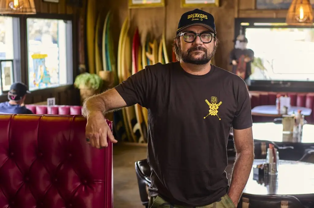
Captain Keno’s No. 8 special—pancakes, sausage, toast, home fries, and eggs for $2.99—was the fuel that powered Benji Weatherley for surf competitions as a teenage pro. A couple decades later, tears were shed when the Coast Highway dive-slash-eatery called it a day after 54 years. Usually, the guts of a shuttered restaurant go to liquidation auctions or straight to the dump to decompose along with its legend. Instead, Weatherley took in Keno’s spare parts—plus other relics from Encinitas’ past—and used them to build the newest community hangout.
Every single piece in the place is from somewhere in this town,” Weatherley says about Breakers Cafe Bar & Grill. “I’m not going to settle for anything less.”
Breakers is a Hawaiian hideout in an uncool part of the coastal surf town, but it’s got the set design of an Encinitas superfan. The plates, silverware, and coffee mugs are from Keno’s. So are the tables and booths. There’s a bench made from the last table preserved in The Derby House (a building that, for over a century, was a hotel, then became a hospital, a religious retreat, and a private home). Weatherley’s not performing CPR on old upholstery because he’s a fan of antique furniture. It’s a method to bring people together.
“Representing nostalgia in this town is the only way to grasp a hold of the community,” Weatherley says. “Everyone wants to touch and feel something different from what they’re experiencing on their phones.”
Photo Credit: Matt Furman
Every week, locals bring him photos, artifacts, and bits of paraphernalia from Encinitas’ past and ask Weatherley to give them a new home. “I’ve had ladies who were there when [Captain Keno’s] opened cry in my arms and say, ‘This table is where I had my second birthday with my grandma,’” he says. “They tell me these stories, and I tell them I have all the same stories about my mom.” (Weatherley’s mom first brought him to Keno’s and helped raise the young surfers from the Momentum Generation documentary—Weatherley, Taylor Steele, Rob Machado, Kelly Slater, etc.—as they surfed some of the world’s most dangerous waves at Pipeline in Hawaii. Back then, she owned Breakers Restaurant & Bar in Haleiwa. Name sound familiar?)
Weatherley has always been the funniest man in the room. He calls Breakers “the Chuck E. Cheese of Encinitas.” The restaurant hosts hula dancing classes, open-mic comedy nights, and evenings bartended by longtime Captain Keno’s barkeep Vaka Kaufusi. Cult-loved reggae band Steel Pulse hit the Breakers stage recently to perform a new song that Weatherley also helped write. His longtime friend Jack Johnson has dropped by to sing a few, too.
Despite not having a fancy location along the 101, people are catching on. Fire stations and hospitals have held staff parties there. Weatherley also currently sponsors four sports teams.
“Last night, I had a girl say, ‘I want my birthday party at Breakers,’” he says. “That, to me, is community in a nutshell.”
Emma Veidt is an editor at San Diego Magazine. She earned her bachelor's and master's degrees from the Missouri School of Journalism. She loves running, hiking, and rock climbing, but really, she mostly loves encounters with the street cats around North Park.
Siblings make better music. That’s the hot take, and there’s some logic and science behind it. The Bee Gees, Jackson 5, Billie Eilish and Finneas, AC/DC, Van Halen, The Allman Brothers—heck, even the Hanson brothers, why not? Beyond just a shared sense of taste and nonverbal communication developed over decades of living and evolving together, there’s a thing called “blood harmony.” The genetically similar throat cavities, vocal cords, speech patterns, and resonant bone structures all blend each unique voice into a more homophonic sound than what comes out of two non-related singers.
Those throat cavities are working wonders for emerging San Diego band We the Commas—three brothers (from oldest to youngest) Lenny, Jordon, and Cam Comma.
Raised in Vista and Carlsbad, the family opted out of cable TV (video games got a pass). Without binge-watching to fill bored hours, the trio turned to music. Guitar Hero led to GarageBand and finally to live instruments—guitars for Lenny and Cam, drum set for Jordon. In their sound, the influence of Stevie Wonder, Erykah Badu, The Who, and Dave Matthews Band is obvious, and so is surf culture, specifically that laid-back chill of North County surf culture.
“We’re like the Black Beach Boys,” Cam says. (Note: Three of the five founding members of the Beach Boys were siblings—the theory gets stronger.)
Their debut EP pretty clearly lays out how they see their sound—titled SARB, an acronym for Surf Alternative R&B. That resonates in the song “Sherry,” with its easy-listening, windows-down-on-the-101 vibe. It also works in the louder, surf-punkier “Pissed Off.” Despite some advances in reducing core stereotyping tendencies, people still tend to autofill Black musicians into rap and R&B. The Comma brothers immediately circumvent that by declaring themselves out the gates.
“SARB makes it so [listeners are] open to all of the things that we want to do,” Lenny says. “From there, you can put a label on whatever you think it sounds like.”
Courtesy of We the Commas
People—and musicians further up the stream—are taking note. In 2023, they co-wrote the song “I Keep Fallin’” with Eric Cannata, guitarist for multi-platinum SoCal band Young the Giant. In early 2024, they were tapped to open the national tour of Brooklyn’s jazz-pop heroes, Sammy Rae & The Friends. Comedian Gabriel “Fluffy” Iglesias invited them to warm up his show at Pechanga a couple months later.
“We really believe genuinely, with our whole hearts, minds and souls, that this is going to work the way that we think it’s going to,” Cam says, grinning ear to ear.
Currently, the Commas live together in Vista, and the dream, wholeheartedly, is more alive than ever. They’ve put out two dozen singles and a trio of EPs: SARB (2020), Old School Love (2021), and Aeroplane (2024); this year alone brought the release of three new singles, including “Let Me,” a silky-smooth entry in their growing collection of love songs.
“We fully realized the magic is in all of us together,” Lenny says. “We know that this doesn’t happen without each person, and we have respect for each other because we need each other.”
As they grow as brothers and as a band, the Commas try to always remember what unified them in the first place.
Ryan Hardison is a freelance arts and entertainment writer and recent graduate of San Diego State. When he's not staring at his laptop, he's likely eating an adobada burrito or getting sunburnt at the beach.
How Scrojo Became One of Rock’s Most Prolific Poster Artists
The San Diego designer has created more than 3,000 concert posters over nearly 40 years for artists including the Rolling Stones and the Red Hot Chili Peppers
When he was in high school, he and his friends were trying to come up with the perfect name for their punk band that would encapsulate all their personas. Nicaragua. The Freds.
One of his friends said he was going to go by Jimmy Stacks and called it “the perfect rock and roll name.” Their names changed so much that Haskett erupted: “Fine, I’m f—ing Scrotum Joe, the true defender of the Open West.”
Their response: Wow, that’s a great name.
As a teenager, he drew chalkboards for Del Mar’s Pannikin coffee shop and would design T-shirts for surf/skate brand Life’s a Beach. He signed the shirts with his moniker, but even in punk rebellion, who wants a shirt with the words Scrotum Joe on it? “They just cut out the ‘t-u-m,’ and the next thing you know, a client referred to me as that, and it stuck,” he says.
Courtesy of Scrojo
Scrojo could have been part of a band as iconic as The Misfits—had he been able to learn the famously cumbersome bassline to The Kingsmen’s “Louie Louie.” Becoming one of the most renowned concert poster designers—someone who quite literally designed the cover of Art of Modern Rock: The Poster Explosion—is a pretty good Plan B.
“To my knowledge, he’s done more rock posters than anybody else alive,” says Dennis King, whose D. King Gallery in Berkeley, California, serves as one of the largest private rock poster collections in the world. “He’s the hardest-working guy in the poster business.”
King not only co-authored the sequel to music historian Paul Grushkin’s The Art of Rock, but he also handles distribution and sales for all of Scrojo’s work. That’s more than 3,000 different posters over nearly 40 years. (That’s over one poster each week. For four decades straight.)
For anything from boxing matches to rodeos, posters have long been used as promotional items. Toulouse-Lautrec’s famous lithographs advertised Moulin Rouge in the late 1800s. Around the same time, Hatch Show Print in Nashville was making handbills for the Grand Ole Opry.
“I propose this: Cave paintings are the first poster art,” Scrojo says.
Courtesy of Scrojo
Rock and roll posters took off in the 1960s, when the hippie counterculture era replaced conformity and suburbia. Artists like Jimi Hendrix and the Grateful Dead used their vibrant, psychedelic prints as a form of rebellion from the mainstream. Posters were promotional, commemorative, collectible, and especially expressive.
If the name Scrojo is any indication, he doesn’t shy away from imagery that toes the line of being too provocative. He focused more on what inspired him instead of trying to be offensive for the sake of getting attention.
“Didn’t want to show it to my grandmother, but my parents were fine with it,” Scrojo says with a laugh.
“We’ve had to ask him to put a Band-Aid over a nipple every now and then,” says Chris Goldsmith, president of Belly Up Tavern in Solana Beach, where Scrojo started out and hundreds of his posters currently line the walls.
Scrojo spent six weeks at Otis College of Art and Design for a summer semester before drugs, alcohol, and a self-described lack of discipline prevented him from enrolling full time. Still, he taught himself concepts like text hierarchy and later found his niche at the Belly Up and in the surfing and skating world, working with brands like Quiksilver, Rip Curl, Scorpion Bay, and DGK.
His first concert poster was for North County band Borracho y Loco, of which Goldsmith was bass guitarist. Scrojo drew an abstract version of the Belly Up’s iconic shark with colorful calypso and tiki themes.
Early on, he would craft using a pencil, pen, non-reproduction blue pencil, X-Acto knife, rubber knife, and proportion scale to create each poster, and the finished product could take a week or even longer.
Courtesy of Scrojo
“I recommend every artist coming up to do that for like six weeks,” Scrojo says. “It forces you to think about every design decision as you’re going along.”
He has since mastered vector imagery through Adobe Illustrator to the point where, depending on the level of detail needed, he could finish two projects in a day. Still, he fills sketchbook after sketchbook to blueprint.
“I liked his line in particular, and he knows how to draw, which a lot of people don’t really know how to do these days,” King says.
Scrojo would research what each musician’s merchandise looks like to get a feel for each artist’s tone and voice. Once he has his central image in mind, he focuses on what and where to place the text.
He doesn’t have one specific style, ranging his talents from art deco to psychedelic and everything in between (and outside the lines). Want a pop surrealist comic book cartoon devil with splattered paint textures, halftone dot patterns, and pure chaos? Red Hot Chili Peppers, February 1986. Want a minimalist graphic portrait with bold strokes and graffiti text? P!nk, October 2023. Want a carnival sideshow style piece with a tasteful caricature of Jeff Bridges? The Big Lebowski, August 2011.
Scrojo calls himself a jack of all trades because he can create posters for all music genres. King calls him a chameleon for his ability to adapt his voice to new eras.
Courtesy of Scrojo
“The variety of his skillset makes it possible for us to put 50 of his posters on a wall next to each other and have it look compelling, not just a bunch of the same thing over and over,” Goldsmith says.
Some of Scrojo’s favorite posters are when he feels a personal connection to the artist or the album. He has a vivid memory as a child of being trapped in a closet filled with marijuana leaves while playing hide and seek and staring at Jimmy Cliff’s “The Harder They Come” LP. “For whatever reason, as a kid, that sparked a desire to do graphic design,” Scrojo says.
Fast forward to February 2012, Cliff is performing at Belly Up. Scrojo decided to modify Cliff’s original album cover from rainbow gradient fills to classic reggae psychedelia while preserving Cliff’s striped pants and bold hat. Cliff’s manager called him and said they wanted to use it for the rest of their tour.
“We always get artists requesting that he does their posters,” Goldsmith says. “A lot of artists don’t want venues to go all rogue because they want to control how they’re being presented. With him, they’re like, ‘Let him go nuts.’”
Matt Eisenberg is an award-winning writer and photographer based in San Diego. A former ESPN editor, his work has also been published by CNN, Bleacher Report and the New York Daily News.
Finding a gift that feels truly personal can be surprisingly difficult. In a sea of generic options — flowers, gift cards, candles, and the like — Xplosion Box offers something more lasting: a customized keepsake built around the photos, messages, and memories that matter most.
Founded by Southern California entrepreneur Jay Vijay, Xplosion Box LLC creates fully customized explosion gift boxes that arrive professionally designed, printed, assembled, and ready to gift. Each box opens layer by layer to reveal personal photos, heartfelt messages, pull-out albums, origami-style photo pockets, and hidden notes, turning a simple gift into an emotional reveal.
The brand was built for people who want to give something meaningful without spending hours printing photos, cutting paper, folding cardstock, or assembling a DIY project. Customers simply choose a box, upload their favorite photos, add personal messages, and the Xplosion Box team transforms those details into a polished keepsake that feels thoughtful, personal, and beautifully made.
Xplosion Box offers personalized gift boxes for birthdays, anniversaries, weddings, graduations, Mother’s Day, Father’s Day, Valentine’s Day, Christmas, proposals, bridesmaid gifts, long-distance relationships, and thoughtful “just because” moments.
Customers can choose from flexible customization options starting at $27. The Mini Surprise Box includes 10 photos, three message cards, and one hidden secret note, while the Mega Surprise Box offers a fuller keepsake experience with 40 photos, three message cards, and one hidden secret note.
What sets Xplosion Box apart is its high level of customization combined with convenience. Filled with personal photos, custom text, decorative details, and layered surprises, each box gives customers the freedom to create a gift that feels one-of-a-kind — without having to make it themselves.
At its core, Xplosion Box helps people turn favorite photos, stories, and words into something tangible: a keepsake that can be opened, revisited, and remembered long after the occasion has passed. asion has passed.
The inland North County community of Rancho Santa Fe is often associated with wealth. It’s one of San Diego’s most expensive residential markets and is consistently ranked one of the highest-income zip codes in California and the U.S. Rancho Santa Fe is known for its large equestrian community including riding facilities and horse trails, as well as its country club lifestyle and associated golf courses.
At the center of this luxury master-planned community is a small, walkable downtown area referred to as the “village,” with The Inn at Rancho Santa Fe acting as both a landmark and social hub. Much of the community, including the historic Inn, was designed by acclaimed architect Lilian Rice, one of California’s earliest female architects. The Spanish Colonial-style architecture she brought to the village is still one of its defining characteristics today.
Whether you’re coming to Rancho Santa Fe for golf, horseback riding, or pampering at a resort spa, be sure to start with a short walk around the village to take in the neighborhood’s charm. Plan your next visit here with our neighborhood guide to the area’s best restaurants, things to do, and shopping.
Rancho Santa Fe Restaurants, Bars, and Coffee Shops
The Pony Room
Families congregate at The Pony Room for elevated California ranch-style cuisine. Lamb lollipops, carne asada tacos, burgers, and weekly dinner specials are offered here, alongside an extensive collection of wine and spirits (especially tequila) and sizeable kids menus. As the signature restaurant of Rancho Valencia Resort & Spa, this all-day eatery is a lively centerpiece of the local social scene.
5921 Valencia Circle
Mille Fleurs
The piano bar at Mille Fleurs is the buzziest spot to be on Friday and Saturday nights in Rancho Santa Fe. French classics like escargot, lobster bisque, duck confit, and steak frites are the main dinner attractions at this local institution that has been around for more than 40 years. Spring for the four-course prix fixe menu before nabbing a coveted bar seat near the piano entertainer.
6009 Paseo Delicias
Nick & G’s Restaurant
Nick & G’s is one of the most prominent restaurants in the village, with an outdoor patio that overlooks the main thoroughfare. Enjoy modern Italian food, steaks, and seafood dishes here, including homemade pasta, pizza, wagyu beef, and oysters. Be sure to check their live music schedule and events calendar for the latest happenings.
6106 Paseo Delicias
Lilian’s
Named after renowned architect and planner Lilian Rice, Lilian’s is The Inn at Rancho Santa Fe’s flagship restaurant. Their upscale menus feature sustainable seafood, grass-fed meats, local produce, and even sushi rolls during dinner. Outdoor seating provides a bird’s-eye view of the village and an elegant backdrop for weekend brunch. Stop by Bing’s Bar (a nod to Bing Crosby) for craft cocktails, beer, wine, and light bites in a refined setting.
5951 Linea Del Cielo
Thyme in the Ranch
Quaint cafe and bakery Thyme in the Ranch serves a small selection of breakfast and lunch items (don’t miss the tarragon chicken salad), but is perhaps best known for its pastries and baked goods. Cakes, pies, muffins, scones, and cookies fly off the shelves here, where locals come for special occasions, parties, and group catering orders.
16905 Avenida De Acacias
Paseo RSF
Located inside a historic building once home to Rancho Santa Fe’s original schoolhouse, Paseo RSF is one of the village’s newest dining options. The charming American bistro has pasta, salads, burgers, meat and seafood entrees, plus a thoughtfully selected California wine list and new sushi and omakase program. Kids and dogs are both welcome here.
6024 Paseo Delicias, Suite C
Rancho Roasters
Grab a quick coffee to go from this walk-up window in the same shopping center as the post office. Cinnamon roll lattes, cold brew, spiced chai, smoothies, protein bowls, and more can be found at Rancho Roasters, where they brew beans from Dark Horse Coffee.
16950 Via De Santa Fe
Goli Pizza
Casual pizzeria and martini bar Goli is a popular spot for catching the latest sports games. Order one of their unique specialty pizzas like the Casbah with hummus and veggies, build your own pizza or burger, or go with one of their hearty wraps that’s made with an extra thin version of pizza dough.
18021 Calle Ambiente, Suite 403
Cocina del Rancho
Find generous portions of Mexican food at Cocina del Rancho, run by the same owners as Carlsbad’s Cicciotti’s Trattoria Italiana and Village Kabob. Get classic dishes like burritos, tacos, and enchiladas, plus their specialty items including pulpo, carne asada, and fajitas with lobster tail. Don’t skip the margaritas.
Kai Oliver-Kurtin is a San Diego-based writer who covers travel, dining, events, and culture. Her writing has been published in USA Today, Condé Nast Traveler, Fodor's Travel, Marie Claire, and HuffPost, among others.
If you’re anything like me, you’ve probably been planning your wedding your entire life. The impromptu daydreaming usually comes at the most inconvenient times: during a meeting or right as you’re falling asleep after watching too many episodes of TLC’s Four Weddings.
In those imagined scenes, there is always a sunset. Usually some kind of impossible garden that feels like Alice in Wonderland meets The Secret Garden. There are soft pinks and climbing greens, florals that look like they grew a little too perfectly on purpose, and somewhere in the distance, water that catches the light. It’s dramatic in the best way.
Perched on Harbor Island, Sheraton San Diego Resort feels like a tucked-away bayside escape. But the real centerpiece of its $123 million transformation is the new Garden Terrace, a private green oasis that feels like it was designed specifically for the dream wedding replaying in my head. This is what I had been imagining all those years. White tea roses, lavender, gardenia, jasmine, and magnolia trees line the space, creating a fragrance that feels like it’s part of the architecture.
Courtesy of Sheraton San Diego Resort
Sheraton San Diego Resort has always had the advantage of its location, but what stands out now is how intentionally the indoor and outdoor spaces coexist. Panoramic harbor views stretch across the property, shifting from soft blue mornings to golden-hour glow and a nighttime skyline that feels almost cinematic. Of course, there are other ceremony and event spaces across the resort, too—including the Lanai Lawn, Harbor Vista Lawn, and Eventide Gardens—each offering its own variation of open-air beauty. But the Garden Terrace is the one that feels like it was made for vows.
I arrived on a Tuesday afternoon with a suitcase slightly overpacked, the result of not knowing what to fully expect from a resort doubling as a wedding venue. I tried to cover every possible version of the trip: a handful of summer dresses, a few breezy pants, marina-esque tank tops, sandals for everything, and accessories meant to sparkle in the sun (seven different earring and necklace options was probably unnecessary, though).
I did, however, underestimate the swimsuits, especially once I saw the paddleboards, endless water activities you’d want to try at least once, and pools and jacuzzis practically whispering your name. Business casual never made it out of the suitcase, replaced instead with easy cover-ups, pinks and greens, and airy button-ups that felt more in tune with the setting than structured jackets ever could.
The resort has been reimagined across rooms, dining areas, and outdoor spaces, with thoughtfully layered tile textures, lighting that shifts with the time of day, warm-toned palettes in the dining rooms, and fresh blues in the bedrooms that complement the views pouring in through the windows. The foyer feels expansive, framed by floor-to-ceiling windows and designed to bring a little bit of San Diego inside with you, rather than shut it out.
Courtesy of Sheraton San Diego Resort
By late afternoon, I was sitting by the marina watching the water shift colors in real time, the kind of view that makes everything feel slower without trying. Dinner at Rumorosa brought the first real taste of the resort’s Cali-Baja identity, starting with a trio of margaritas—passion fruit, spicy watermelon, and creamy coconut—that made it impossible to pick a favorite and slightly dangerous to have them all in front of you at once.
The table opened with guacamole layered with spicy cotija, radish, pomegranate seeds, candied serranos, cilantro, limes, duritos, and warm tortilla chips, followed by Mexican street corn with sweet kernels, spiced aioli, cotija, and more candied serranos that hit just enough heat to keep you absolutely addicted.
For my main, I went with the roasted organic chicken breast with buttered jasmine rice, mole negro, and roasted cauliflower, which felt familiar in structure but elevated in small details like the cilantro and pickled onions. And then the Carajillo tres leches cake, a vanilla sponge layered with coffee and Licor 43 mousse, praline, and caramel sauce, arrived and disappeared faster than it probably should have.
What made it feel so curated wasn’t just the menu, but how intentional everything felt without ever feeling fussy: bright flavors balanced against rich ones, heat against sweetness, and plates that arrived right as the light over the marina started to soften. The next morning carried that same energy. Breakfast could unfold at your own pace, whether that meant taking a Zoom call in your room, heading downstairs for a sit-down meal with friends at Rumorosa, or grabbing something quick from Strada Italian Market. I opted for a vanilla latte from La Colombe at Strada before heading out for the morning.
Courtesy of Sheraton San Diego Resort
I made it just in time for the resort’s complimentary morning yoga on the lawn, boats just visible beyond the stretch of green. The Sheraton offers it daily as part of the stay, a low-pressure option for anyone looking for an easy reset rather than a full workout, which I wasn’t expecting to take part in on this trip but ended up glad I did. The class itself was beginner-friendly, with slow flows and a few optional deeper stretches for anyone who wanted to push into more advanced poses.
Afterward, stand-up paddleboarding shifted everything into a different perspective. My small group launched from the resort’s private dock, boards wobbling slightly as we found our balance, then drifted out into the marina where the water opened up in every direction. We paddled past rows of docked boats, slipped alongside houseboats with their shaded decks and string lights, and followed the gentle curve of the harbor as it widened and narrowed again.
The afternoon transitioned into poolside lounging at Sunglow Cabana Bar, where cabanas, cold drinks, and a poolside lunch had me so relaxed I didn’t even realize my phone had died. Sunglow is open to the public, so if you’re looking for a quick day getaway, you can dock and settle in for SoCal-style shareables and frozen drinks.
Courtesy of Sheraton San Diego Resort
Dinner at the Garden Terrace kind of shifted everything for me. In the daytime it just feels like a nice open space, but at night it becomes something else entirely: more intentional, more “put together” in a way I didn’t really clock at first. As the sun went down over the marina, everything turned warm and the garden lit up in this soft glow that was staged under fairy lights. It was as if you were meant to experience it in this very certain way.
It was easy to picture it then: the quiet before guests arrive, the moment someone steps forward, the pause right before “I do.” There’s often a specific kind of silence right before a ceremony begins. And, at the Garden Terrace, that feeling is built into the space itself. You are standing in a garden wrapped in white blooms and soft greenery, with the harbor stretched out just beyond it. The sun is low enough to turn everything gold. Someone is standing across from you, close enough that everything else fades into background noise.
That evolution, according to Sean Clancy, Vice President and General Manager of Sheraton San Diego Resort, has been years in the making. He describes the property as having been “completely transformed,” from the rooms to the restaurants and everything in between, with new spaces like the Garden Terrace designed to highlight the marina backdrop in a way that feels “naturally stunning” and “magical,” not just scenic.
By the time I checked out on Thursday, watching the sun rise over the marina, empty in the early light, I understood why someone would choose this exact spot to say something they mean forever.
Isabella Dallas is a freelance writer for San Diego Magazine and the Arts and Culture Editor at The Daily Aztec in her final year at San Diego State University. She previously worked as an editorial intern for SDM, but when she’s not writing, you can find her trying the best coffee spots in SD, devouring the latest rom-coms, and indulging in anything and everything pop culture.
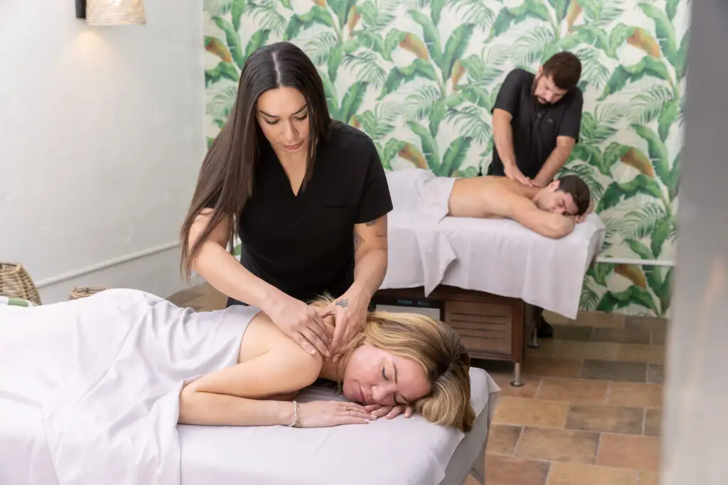
If you’re anything like us, it can be easy to get so caught up in taking care of everyone else, that your own needs get lost in the ether. But while this may be a cliché, that doesn’t make it any less true: You can’t give your best self to other people unless you’re taking care of yourself.
Sometimes, that looks like stopping in for your regular acupuncture or chiropractic appointment. Other days, it means giving your body the fresh, organic fuel it needs to truly feel and function at its best. And some other times still, it involves leaving your responsibilities behind for a weekend to pamper yourself at an incredible resort and spa.
Only you can decide what your truly need. We’re just here to help you find the best ways to get it.
Tommy Bahama Miramonte Resort & Spa
Island living meets desert luxury at the Tommy Bahama Miramonte Resort & Spa in Indian Wells. When you step onto the 11-acre property, you’ll be surrounded by sweeping view of the Santa Rosa Mountains with olive trees and fragrant citrus groves decorating the grounds. In other words, everything about this relaxed but refined resort is primed to help you let go of the stress from home and enjoy easy sun-soaked days and gorgeous starry nights.
The rooms blend calming, woven textures with Tommy Bahama’s signature tropical prints and feature private lanais, making it easy unwind the moment you walk in the door. If you book one of the four Villa Suites, you’ll be treated to exclusive Tommy Bahama furniture and unique personal touches to further that feeling of instant ease.
At the award-winning Spa Rosa, the expert team will help reset and recharge your body and mind using methods and rituals inspired by the desert. The 12,000-square-foot retreat includes outdoor soaking pools, eucalyptus steam rooms, and outdoor cabanas, as well as massages, facials, and body masks—all aimed at creating a day dedicated to you. We’re particularly partial to the Day Long Escape, an indulgent all-day affair of CDBs soaks, renewing scrubs, life changing massages, and transformative facials.
Following your treatment, continue the experience with a meal on the patio at Grapefruit Basil. We love the Hamachi Crudo, a light, citrus-forward dish featuring premium yellowtail, house-made ponzu, creamy avocado, and fresh seasonal garnishes.
Whether you’re strolling the gardens, relaxing beside its saltwater pools, or indulging in a restorative treatment, you’ll be able to escape in style and relax in luxury at the Tommy Bahama Miramonte Resort & Spa.
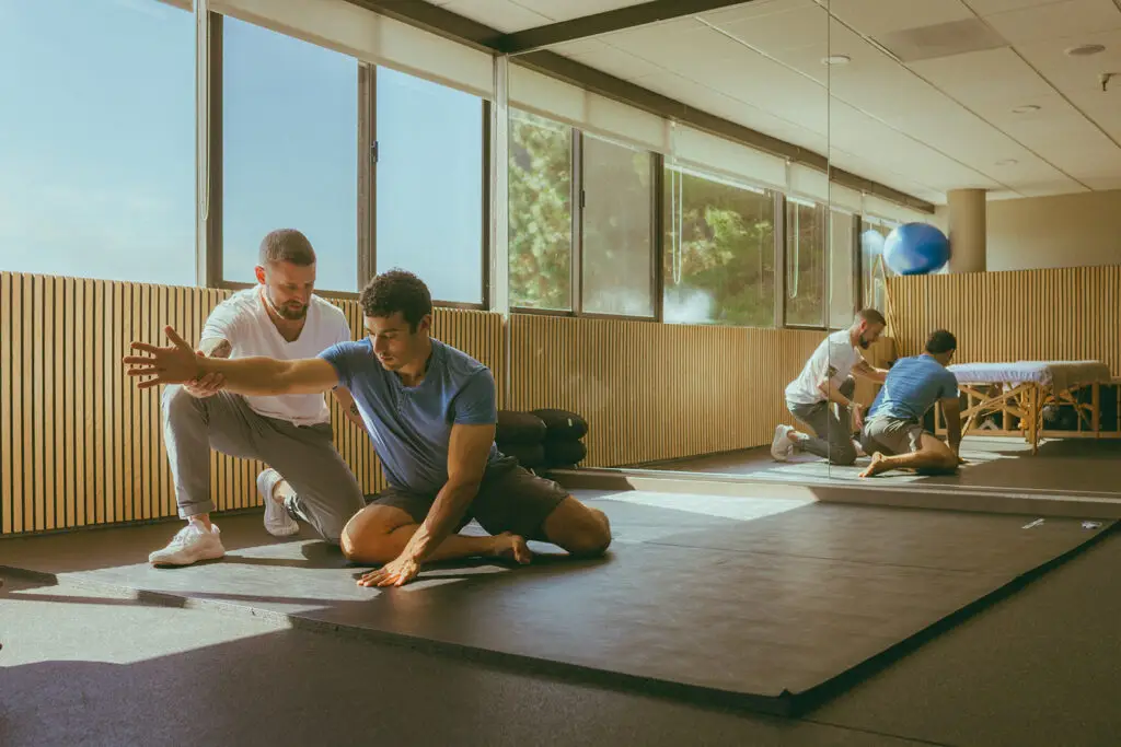
Healcove Chiropractic
There’s no shortage of ways to stay active in San Diego—but if you really want to enjoy everything the city has to offer, you’ve got to make sure you’re giving your body its tune-ups. Enter: Healcove Chiropractic. The board-certified chiropractors and wellness professionals at Healcove are experts at addressing that stage where you’re not injured, exactly, but you’re not at 100%, either. Maybe you’re feeling a bit tense or stressed out. Or it could be that you’re not quite moving the way you want to. Sometimes, it’s just that the accumulation of days, weeks, or even years of daily strain is starting to take a toll. No matter what stage you find yourself at, the Healcove Chiropractic team can provide integrated, preventative care centered on long-term, science-backed approaches that ensure you can always stay active and live the life you want to live pain-free.
This starts by providing truly individualized care. Every patient can expect a thorough 60-minute consultation session that includes a posture and movement screening. This allows the team to develop a completely personalized plan. That plan might include chiropractic care, acupuncture, or massage therapy, as well as functional fitness training, vibration and sound therapy, and Dynamic Neuromuscular Stabilization, a clinical rehabilitation method that retrains the body’s stabilization systems. Whatever the team recommends, you can be sure that it’s tailored to meeting your body’s needs today and the future.
There’s a reason that San Diego Magazine named Healcove the “Best Chiropractor in San Diego”—don’t wait until you’re struggling with an injury to find out why. Book an appointment today for holistic, integrated care that helps ground and heal your body before it reaches a crisis point.
Juice Holler
West Coast wellness culture meets the community feel of Southern Appalachia at Juice Holler. Juice Holler’s menu consists of made-to-order smoothies and smoothie bowls, as well as grab-and-go cold-pressed juices, wellness shots, salads, and more. It operates from the blissfully simple premise that fueling up with food and drink that’s guilt-free and good your body should be simple, accessible, and, above all else, delicious. And if you haven’t yet made it out to the Encinitas café, which opened just this year, let us be the first to tell you: Juice Holler delivers on each and every of these fronts.
We love the Supercharger smoothie, a mood-lifting and body-fueling option made with banana, almond butter, blue spirulina, maca, grass-fed whey protein, raw cacao nibs, medjool dates, and coconut milk. We’re also partial to the Thrive Alive smoothie bowl, where avocado, mango, sea moss, spirulina, mint, coconut milk, and agave are mixed and topped with coconut, chia seeds, strawberry, mango, and chocolate drizzle. The wellness shots include the Detoxifier, a cleansing blend of kale, cucumber, lemon and spirulina, plus a shot specially designed to fight inflammation (named, fittingly, Anti-Inflammation). Probiotic overnight oats, lemon turmeric bars, and strawberry shortcake chia pudding are other standouts on the grab-and-go menu.
Much of the vibe feels beachy North County chic—think green tile with orange and pink accents, grounded with greenery and natural wood—but Juice Holler founder Kelly Sergott, a longtime Encinitas local, has also enfused the space with her Kentucky roots. In Appalachia, a holler is small valley between hills and mountains, where nature reigns, community is king, and nourishment comes right from the land. At Juice Holler, Sergott has created a holler for the busy modern times, using local ingredients to create a spot for people to come together and enjoy fresh, fast, feel-good fuel for their day.
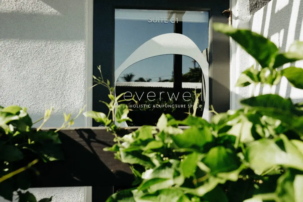
Everwell Acupuncture
We’ve all had that experience with a medical professional where we’ve felt rushed, ignored, or misunderstood—and ultimately, like we didn’t get the answers that we needed. But at Everwell, the holistic acupuncture practice located in Solana Beach, the care team wants to transform your understanding of what healthcare can look like.
Patients at Everwell experience care rooted in intentional listening and radical empathy—and trust us, those aren’t just corporate buzzwords. This place actually puts those ideas into practice. You will always be given the time you need to tell your story— initial in-take appointments are two hours long—and you can rest assured that your story will be believed. Every single question and concern will be addressed by a dedicated practitioner who wants to find the specific solutions that work best for you, and you’ll receive care that’s aimed at healing the body, mind, and spirit.
Everwell’s highly trained, doctorate-level practitioners blend evidence-based acupuncture with the practice of classical Chinese medicine. (If you’ve never tried acupuncture before or aren’t sure if the team will be a fit, we’d highly recommended Everwell’s complimentary 20-minute consultations.) Research shows that by stimulating specific points on the body, acupuncture activates a natural healing response in the body, helping to restore balance, regulate the nervous system, and improve overall wellbeing. This allows the practice to address an incredibly wide range of conditions from chronic pain and autoimmune disorders to digestive issues, from stress and burnout to headaches migraines, fertility and postpartum struggles, hormonal imbalances, sleep concerns and more.
At Everwell, you can expect to feel heard, trusted, respected, and cared for. This is a space that doesn’t want to be just another healthcare provider you visit; it wants to provide patients with dedicated partner who will be there for their entire health journey.