


Southern California offers those lucky enough to live here countless ways to entertain ourselves—plenty of beaches, more than 200 wineries, 120 golf courses, nine big-time professional sports teams, and four major theme parks. But it’s our wilderness that truly sets us apart. SoCal is where three distinct ecosystems—desert, mountains, and coast—collide, making our corner of America a dream for hikers and vagabonds. With over 1,100 miles of hiking paths, from challenging mountain treks to scenic waterfall hikes, desert scrambles, and shady forest walks, there’s no shortage of trails to blaze. So go! Take a hike!
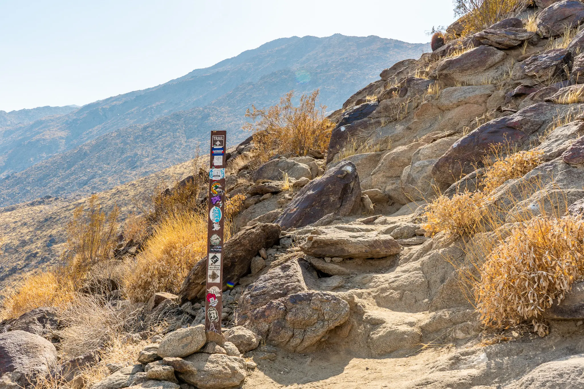
Big Laguna Trail, Mount Laguna
Distance: 10-mile loop | Difficulty: Moderate | Elevation: 944 feet
Mount Laguna, San Diego’s natural playground, is just an hour away from the city center. With panoramic views of the surrounding mountains and valleys, Laguna provides enough immersion in nature to forget you’re 30 minutes from the nearest McDonald’s.

The Big Laguna Trail loops through the Laguna Meadows, past campgrounds, through woods teeming with jays and chickadees, and toward the mountain’s edge overlooking Sunset Highway, with plenty of views along the way, including the Laguna Observatory, which housed the world’s largest telescope until 1976, and a glimpse of Anza-Borrego Desert vistas to the north.
One of the more scenic stretches of the 2,650-mile Pacific Crest Trail, it’s a must for San Diego locals looking for a fresh-air day trip. Shorten your journey by splitting off at the Sunset Trail or Meadow Spur Trail if you’re feeling a bit more leisurely. And, yes, dogs are welcome, so bring company.
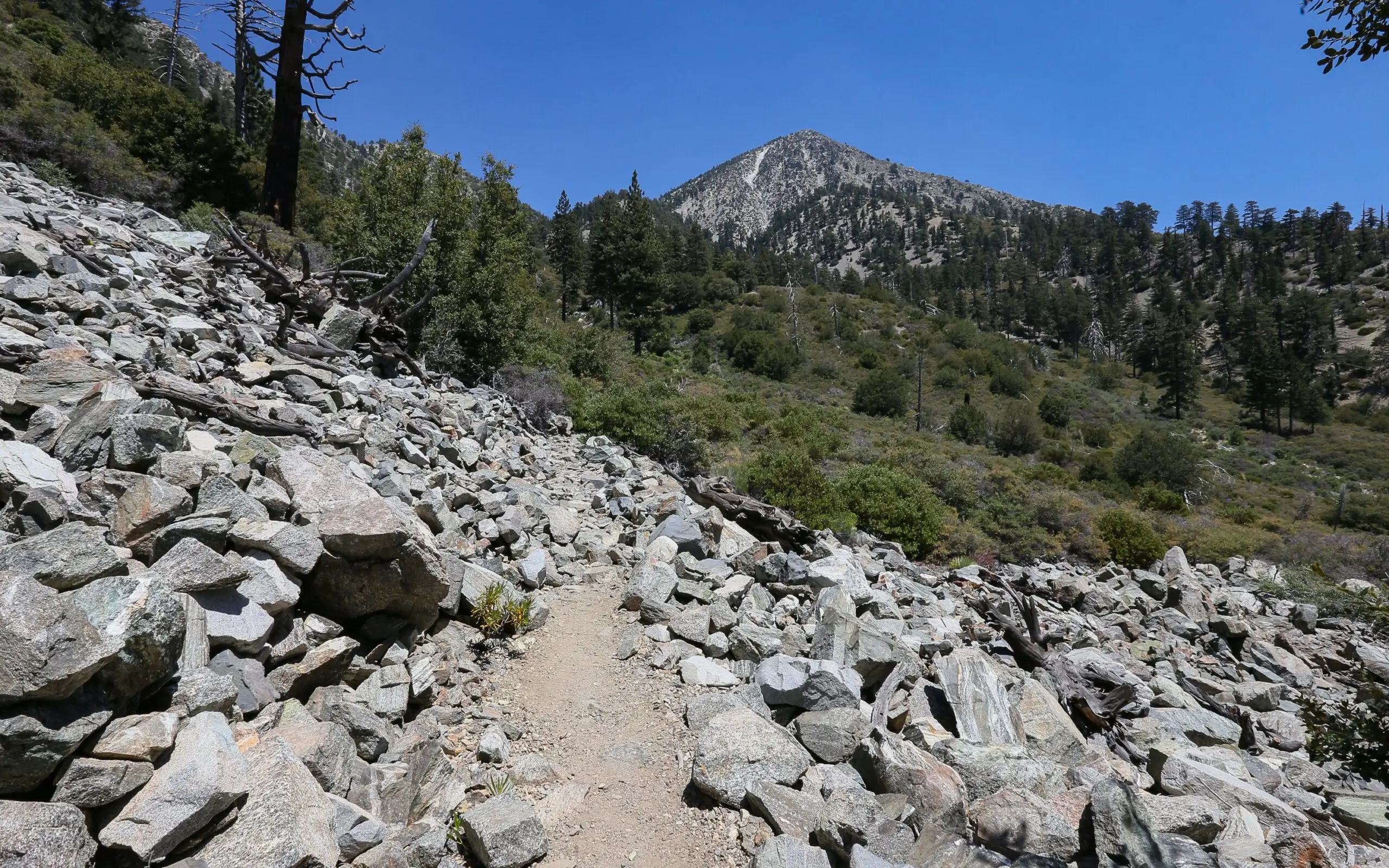
Cactus To Clouds, Mount San Jacinto
Distance: 19.2 miles | Difficulty: Hard | Elevation: 10,000 feet
Cactus to Clouds on Mount San Jacinto is the most challenging hike on this list, with more elevation gain than any other trail in the United States. Legendary conservationist John Muir called San Jacinto Peak “the most sublime spectacle to be found anywhere on this Earth”—and that was after he visited Yosemite. Once you summit it, you’ll understand why. Starting at the cactus-lined base, the trail climbs over 10,000 feet to the peak, offering breathtaking views of Palm Springs and the Coachella Valley and an extra 50,000 steps to your Apple Watch.
This intense hike, which can take 10 or more hours, is not for the faint of heart. The weather conditions can be extreme—temperatures range from 10 degrees to 120 degrees Fahrenheit (and fluctuate significantly from base to summit), with icy conditions in the winter and scorching heat in the summer, so the best time to tackle this trail is in early fall or late spring.
The last tram down the mountain departs at 9:30 p.m., so make sure you start early and keep pace. If you’re unsure about your hiking ability, do yourself a favor and take the tram up to trek the Desert View Trail at the peak for a more manageable and equally beautiful experience, sans suffering.

Cooper Canyon Falls, Mount Wilson
Distance: 6.3-mile loop | Difficulty: Moderate | Elevation: 1,361 feet
Located just an hour northeast of Pasadena off the Angeles Crest Highway, this path (which connects to the Pacific Crest Trail) winds through lush pine and cedar forests, along Little Rock Creek and past Cooper Canyon Campground. Hikers can venture down to the base of the falls via rope line for a refreshing dip under waterfalls that feel like they belong in the Pacific Northwest.
To see the falls at their best, visit in spring or after a good rain—nothing is quite as disappointing as a trickle of water during a drought. But when conditions are right, the soothing sound of cascading water, the fresh scent of pine and cedar carried in the breeze, and the tranquility of the Angeles National Forest create a perfect detox for San Diegans looking to explore or Angelenos escaping the urban sprawl.
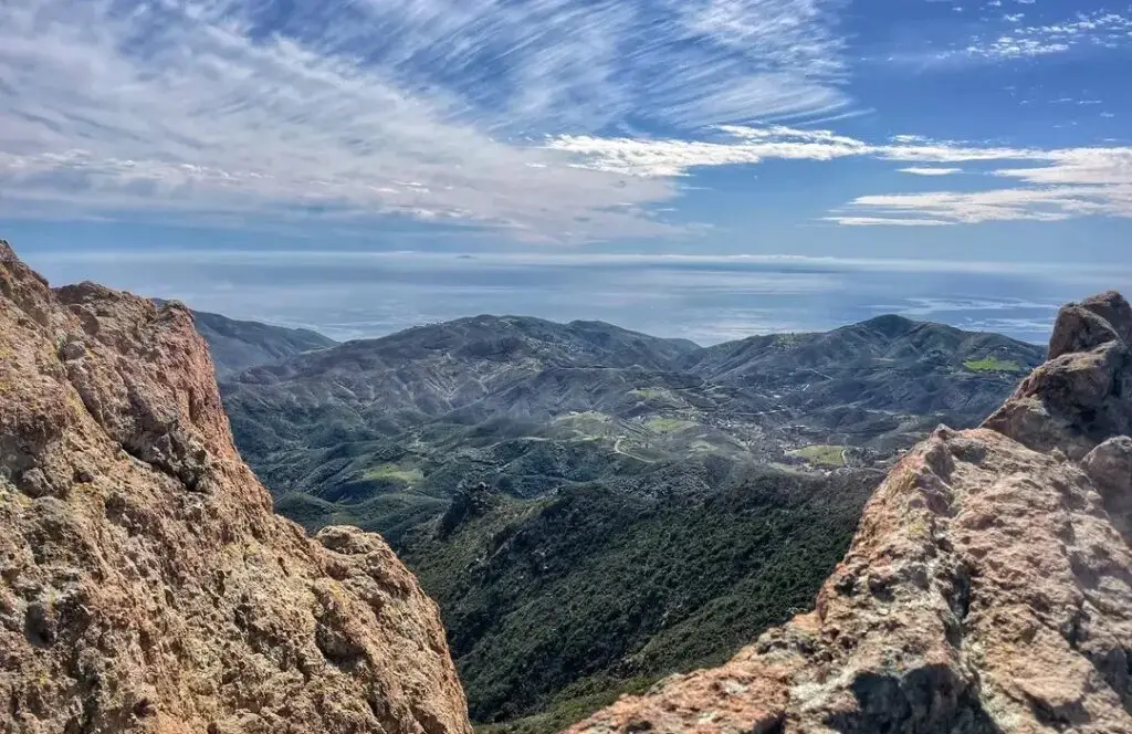
Mishe Mokwa Trail Loop, Malibu
Distance: 5.9-mile loop | Difficulty: Moderate | Elevation: 1,354 feet
The Mishe Mokwa Trail is an underrated gem through the Santa Monica Mountains. Don’t be fooled by its proximity to the city—it packs a punch with panoramic coastal views and some welcome seclusion, all just 25 minutes from Malibu. Thankfully, this trail was spared by the recent Palisades fires, which charred the surrounding areas—a miracle for the City of Angels.
Sandstone Peak, the highest in the Santa Monica mountains, offers a breathtaking glimpse of the Pacific coastline, with sprawling mountains to the east, climbers scaling the nearby Echo Cliffs, and other unique rock formations like Balanced Rock in the distance. It’s a beautiful and easy enough hike for beginners, taking a little over three hours to complete (though it provides limited shade). Once you reach Sandstone Peak, the loop takes hikers past Tri Peaks and Split Rock. You’ll have plenty of opportunities to get lost in nature—so take your time.
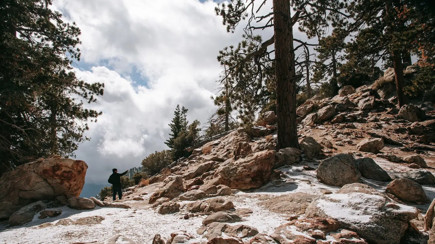
Icehouse Canyon, Mount Baldy
Distance: 8.5 miles | Difficulty: Moderate | Elevation: 2,631 feet
Icehouse Canyon is a versatile trail, drawing hikers, horseback-riders, and even snowshoers, depending on the season. Located just an hour from Los Angeles, this Mount Baldy hike shifts dramatically with the weather, from serene wooded streams in summer to snow-covered paths in winter. The main attraction is Icehouse Canyon Saddle, a dazzling canyon at 7,200 feet showcasing panoramic sights of the San Gabriel Mountains, distant vistas, and the Mojave Desert.
The more adventurous can continue past The Saddle for a challenging trek toward Cucamonga peak or Mount Baldy. Be sure to bring layers—temperatures can vary drastically between the cool, shaded woods of cedar and ponderosa trees and the exposed, sun-drenched peaks. Keep an eye out for the remnants of the Icehouse Canyon Lodge, built in the 1920s as a cabin retreat for Angelenos—a short-lived venture that was largely reclaimed by nature after the Great Flood of 1938 destroyed most of the cabins and a fire in 1988 consumed the lodge.
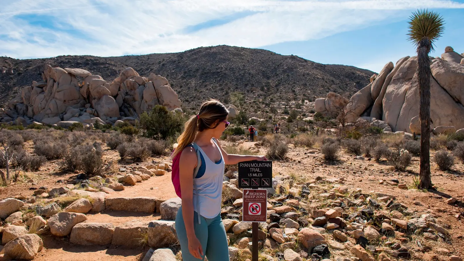
Ryan Mountain, Joshua Tree
Distance: 2.9 miles | Difficulty: Easy | Elevation: 1,050 feet
Joshua Tree is one of Southern California’s natural wonders—a geographic anomaly nestled between the Colorado Desert, San Bernardino, and the Mojave Desert. It’s also a must-visit destination for hikers and rock climbers, thanks to 8,000 climbing routes and over 300 miles of hiking trails. While not the most difficult hike, Ryan Mountain provides one of the best, most easily accessible views of the park and the nearby Coachella Valley.
Start the trail two hours before sunset to experience its full glory, which begins with stone steps before transitioning to a dirt path the rest of the way. Bring a headlamp for the descent, and keep an eye out for snakes and scorpions. Stay the night to take advantage of Joshua Tree’s designation as a dark sky park, meaning you’ll see the Milky Way—and maybe a psychedelic-induced UFO sighting, depending on who you’re camping with.
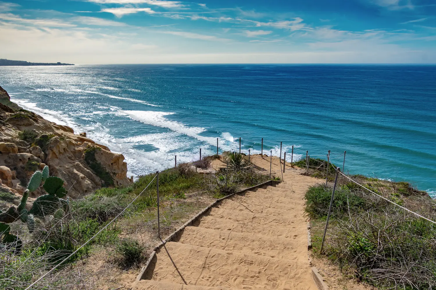
Torrey Pines State Reserve Loop, La Jolla
Distance: 3.7-mile loop | Difficulty: Easy | Elevation: 439 Feet
For the best coastal hike in San Diego, Torrey Pines State Reserve is a must. Perched atop 300-foot cliffs, this reserve is home to the rarest pine tree in the US. One of the connecting trails is named for Guy Fleming, the conservationist responsible for spearheading efforts to protect these unique pines and for establishing Anza Borrego, Cuyamaca, Palomar, and Mount San Jacinto state parks.
Starting from the highway-side parking lot, the trail gently ascends, supplying stunning views before it connects to the dramatic coastal cliffs. Along the way, you’ll encounter tidepools filled with sea anemones, hermit crabs, and other marine life. Stay for sunset to check off another item off your San Diego bucket list. Honor Fleming’s legacy and respect the protected area by refraining from bringing dogs, food, or drones.
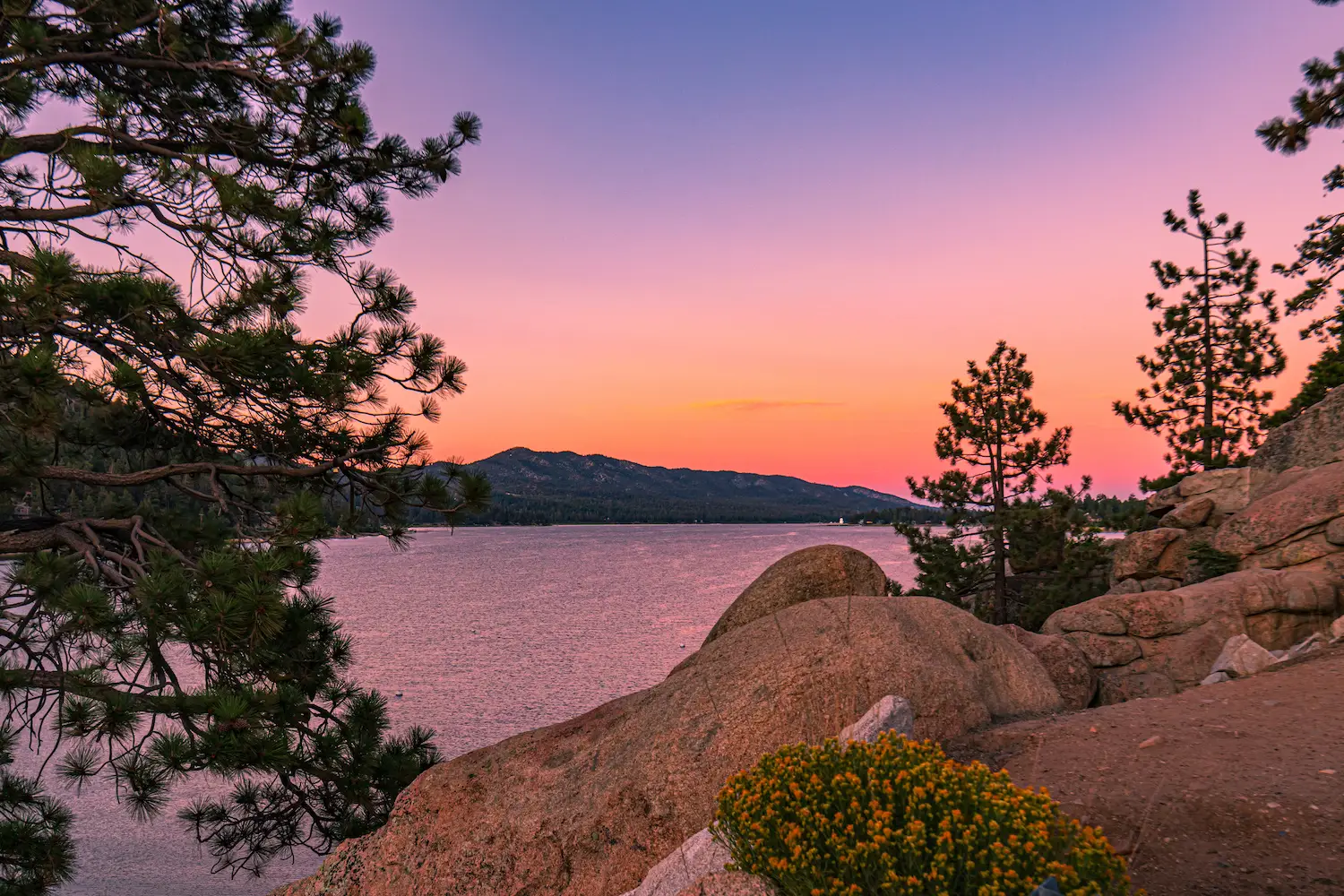
Castle Rock Trail, Big Bear
Distance: 2.7 miles | Difficulty: Moderate | Elevation: 826 Feet
Big Bear is famous for skiing and winter sports, but it’s just as worth visiting in spring and summer. Castle Rock Trail is a perfect introduction to Big Bear’s natural beauty, treating hikers to gorgeous panoramas of the lake, located just off State Highway 18 as you enter town. The trail climbs steeply at first, offering the majority of its scenic vistas early on, while the latter part continues onto Bluff Lake Reserve where you can see cabins and artifacts from the late 1800s.
Follow the mesh bins of rocks which serve as trail markers along the way (though plenty of unofficial trails allow for further exploration). At the top, you’ll find Castle Rock, a 100-foot stone formation popular with climbers and hikers alike—the top is accessible via a smaller rock. If you hit the trail early, you’ll avoid the crowds and might just get a glimpse of the deer and woodpeckers that inhabit the area. Afterwards, end the hike with a cold plunge at Big Bear Lake.
PARTNER CONTENT


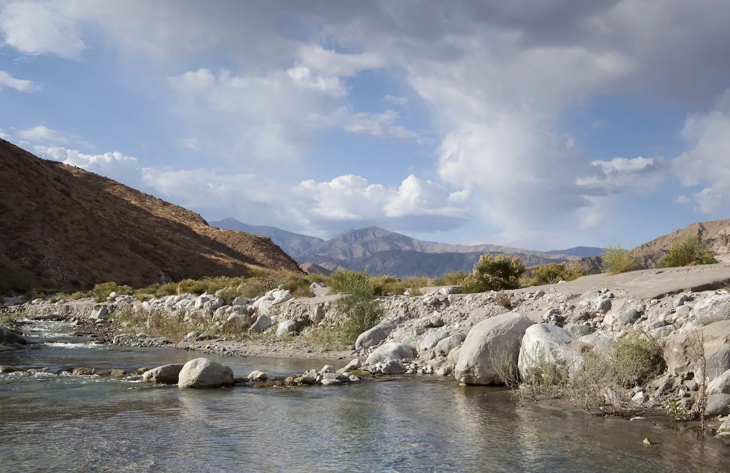
Whitewater Canyon View Loop Trail, Whitewater
Distance: 3.8-mile loop | Difficulty: Moderate | Elevation: 625 feet
Just east of Palm Springs lies a striking patch of unique geography that intersects with the Pacific Crest Trail. From Whitewater Canyon Loop, you can take in broad views of the often snow-capped San Gorgonio Mountain. You’ll cross the Whitewater River—which can be a gentle stream in the summer or a more formidable waterway with a somewhat precarious crossing after rainfalls and runoff from nearby mountains.
And you’ll climb switchbacks tracing the sweeping canyon where bighorn sheep, deer, and bears roam. The area is also home to rare species like the endangered arroyo chub, a small wild population of rainbow trout, and a variety of migrating birds. Be prepared to get wet crossing the river depending on the season, so wear something waterproof. Pro tip: Hike the loop counter clockwise for the best experience—a steeper incline to start followed by an easier descent and rewarding panoramas all the way down.