From Anza-Borrego desert in the south to the redwood forests in the north (and all the beautiful coastline and deserts and mountains in between), California is filled with fantastic hiking trails.
For every massively challenging mountain summit, there’s a gentle, beginner-friendly path through the woods or near the beach. With so many options, it can be tough to choose your next trek—so we surveyed some experts to find 10 of the best hikes in California. Here are their picks.
Courtesy of All Trails
Oak Canyon Hiking Trail (3.3 Miles)
Mission Trails Regional Park
Todd Linke, a board member at the Mission Trails Regional Park Foundation and a high school science teacher, says this easy trail is great in any season. “The oak trees provide comforting shade in the summer [and turn a] brilliant yellow in the autumn. [There’s] flowing water in the winter and babbling rapids in the spring,” he explains. “The star of the show … is the amazing waterfall, which can be viewed from above or at the water’s edge.”
You can start the trail at the Old Mission Dam, which once supplied water to San Diego’s Mission de Alcala. “This trail is as fun as you make it,” Linke says. “There are oak trees to climb, rocks to skip across, and mountain vistas all around.” You can hike out of the canyon and return on the Grasslands Loop Trail, passing the Kumeyaay grinding stones and catching a bird’s-eye view of the dam from the overlook.
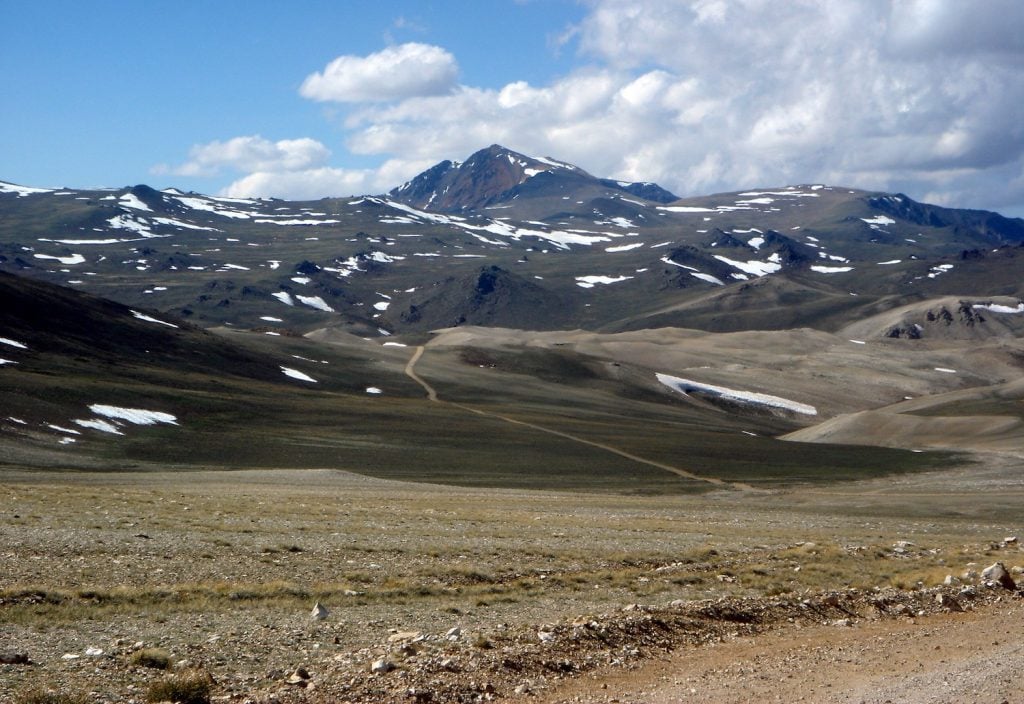
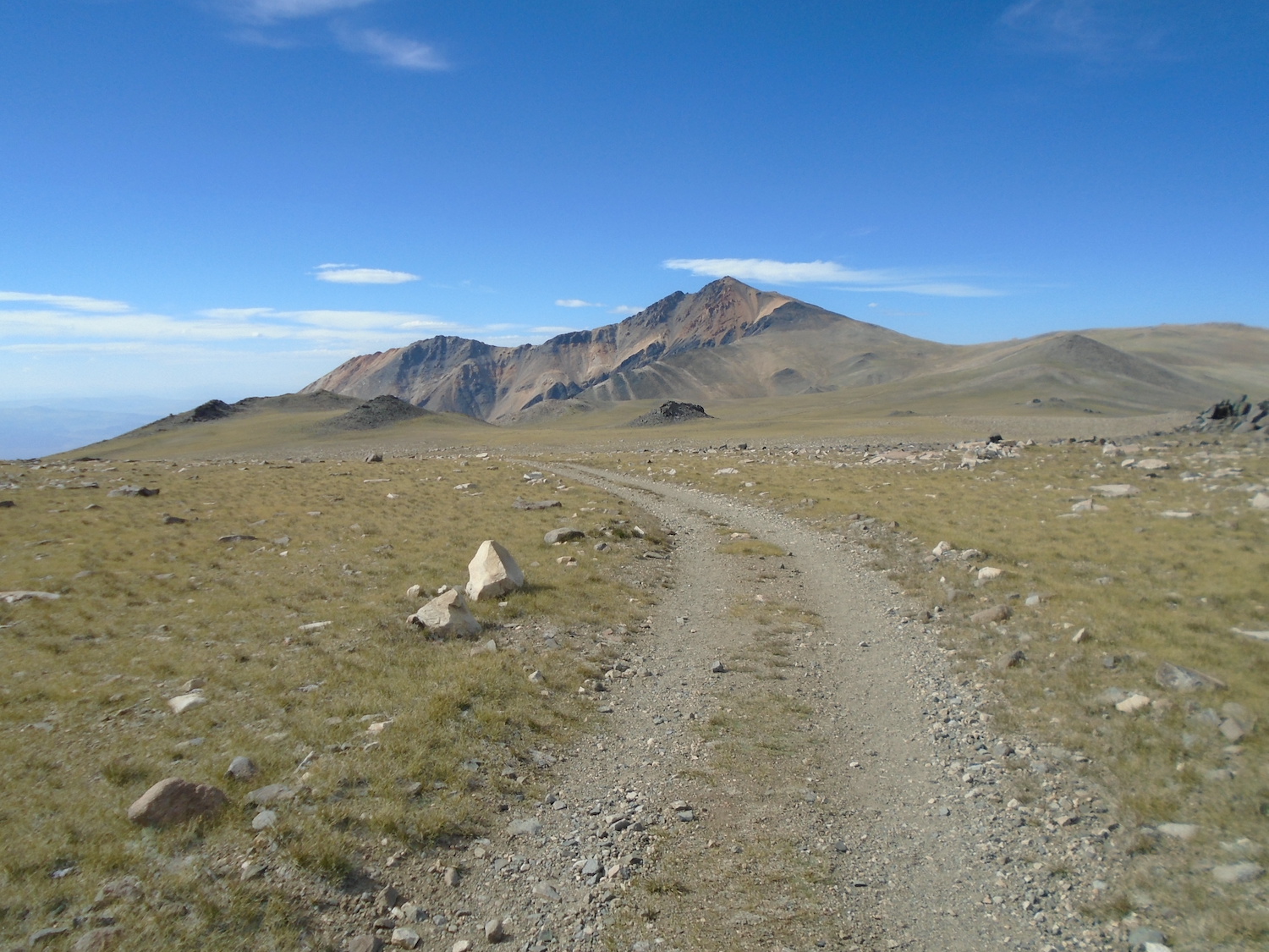
Courtesy of Wikipedia
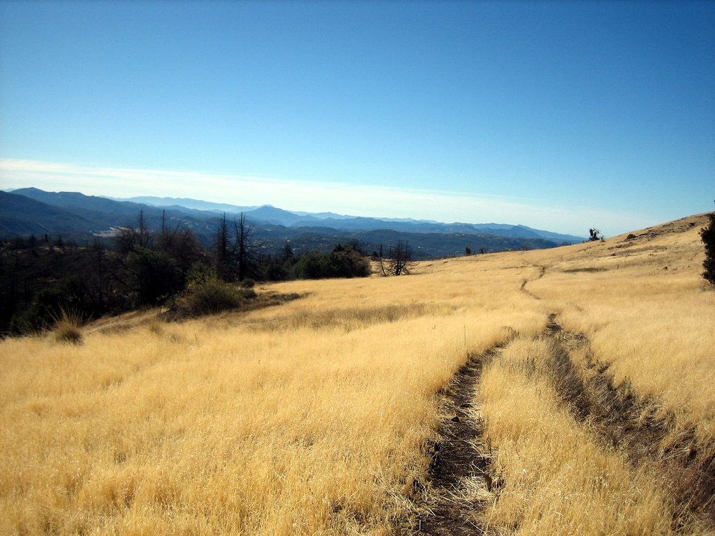
White Mountain Peak Hike (15.2 Miles)
Mono County
Those who have set out to tackle Mt. Whitney know how challenging it is to score a permit. If you’re running into red tape, shift your focus: White Mountain Peak—which, at only 253 feet lower, is the third-highest peak in California—can give you the summit experience without any paperwork or permits. Cris Hazzard, who runs the website hikingguy.com, says that, though you can see Whitney from White Mountain, the peak is not actually in the Sierras.
“Instead, it’s in the unique mountain desert of the White Mountains,” he explains. “The hike is 15 miles with approximately 3,500 feet of climbing. The high altitude will make it feel much more challenging.”
White Mountain Peak’s location makes it extra special—it is also the only mountain taller than 14,000 feet in the lower 48 states that’s not part of the Sierras, Cascades, or Rockies.
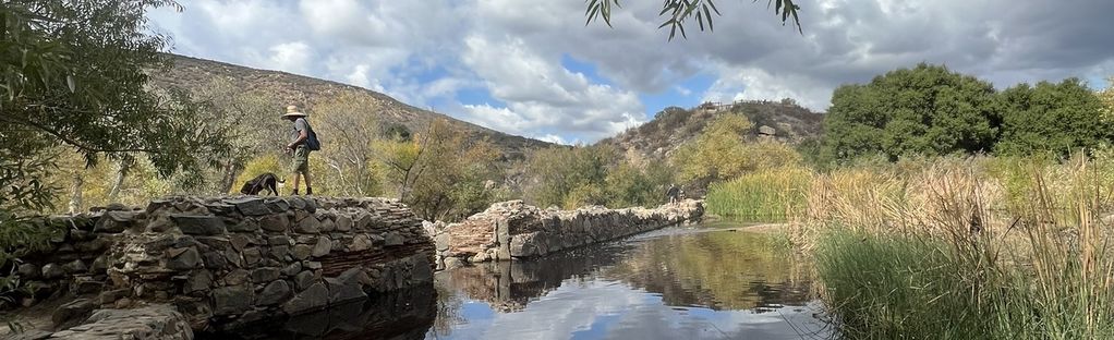
Courtesy of All Trails
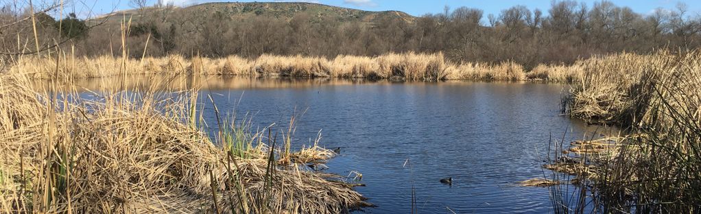
Kumeyaay Lake Hiking Trail (1.3 Miles)
Mission Trails Regional Park
At just over one mile, this flat trail is short and sweet, so it’s a great quick hike to do after work or with kids. “It’ll bring you to a peaceful and beautiful place, with minimal time or effort investment,” Linke says.
Start in the Bushy Hill parking lot along Father Junipero Serra Trail, just off of Mission Gorge Road in Santee. Follow the entrance road to the Kumeyaay Lake Campground and walk around the lake on a mixed dirt and gravel trail. “Although the trail is short, you’ll have multiple opportunities to stop, relax, and enjoy the beautiful view of the lake, as well as the river and a small marsh area east of the lake,” Linke says. “You’d never know the lake was a former quarry, and it speaks to the incredible efforts to regenerate previously disturbed land.”
Philip Erdelsky, the leader of San Diego Day Hikers, says the trail has been one of his favorites since he first trekked it in 1988. “Very little has changed since then,” he adds. “The loop offers a variety of hiking experiences: chaparral, meadows, woods, stream crossings, and impressive views. Since it is a loop, none of it is hiked more than once. Dyar Spring always has water, even on the driest days.”
Courtesy of USDA Forest Service
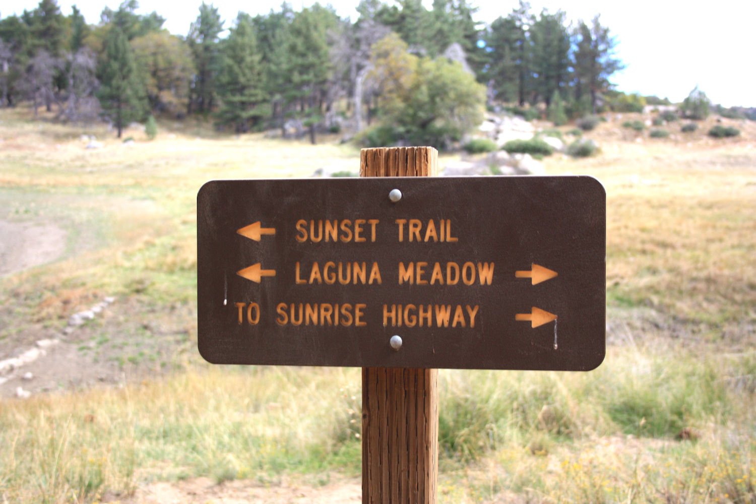
Sunset Trail to Laguna Meadow Hike (8.2 Miles)
Laguna Mountain Recreation Area and Cleveland National Forest
This trail gives you access to distant mountain vistas and Laguna Meadow, plus views of two small lakes—Water of the Woods and Big Laguna Lake—and an array of water birds, insects, and spring wildflowers.
“While Southern California is known for its palm trees and ocean waves, our mountains provide a beautiful backdrop of Jeffrey Pines and Coast Live Oaks, along with fresh air and peaceful tranquility, a perfect combination for a relaxing hike,” Linke says. “In summer, the warmth creates the pleasant aroma of pine, while the shade of the forests give hikers and bikers a respite from the blazing sun. Autumn is a time of brilliance, as the air turns crisp and mountain oaks display their golden beauty along the trail and the Sunrise Highway, one of the most beautiful stretches of roadway in California.”
With winter comes snow, and families can bring sleds to slide down short hills.
Courtesy of Tripadvisor
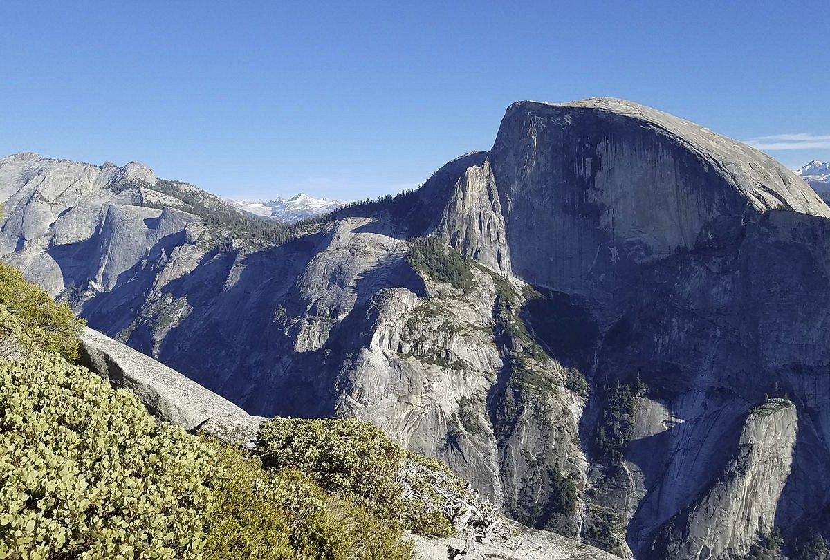
North Dome Hike (9.2 Miles)
Yosemite National Park
While Yosemite’s Half Dome is on many adventurers’ bucket list, a section requiring a steep ascent with only cables to aid you can cause anxiety. To experience a similar trek without the risk, try hiking to North Dome. The path is 9.5 miles with about 2,100 feet of climbing, which is much less than Half Dome.
“You don’t need a permit, and enjoying the granite dome and views is relatively tame,” Hazzard says. “I love this hike because it’s not as crowded as the other Yosemite classics, but it still is a quintessential Yosemite experience.”
Courtesy of Palm Springs Bureau of Tourism
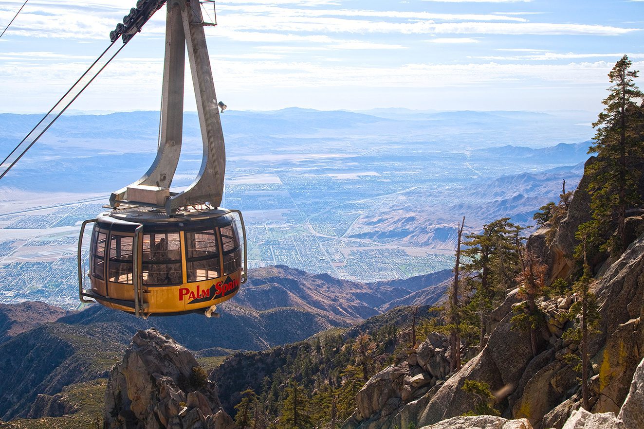
Palm Springs Tramway to San Jacinto Peak Hike
Mount San Jacinto State Park (10.1 Miles)
San Jacinto towers 10,000 feet over Palm Springs, offering an alpine environment with the Sonoran Desert as its neighbor. While the hike from Palm Springs to the summit—called Cactus to Clouds—is one of the hardest in the country, you can trim about 8,000 feet off the journey by taking the tram to Long Valley. (Cactus to Clouds is temporary closed due to heat warnings)
“Once off the tram, you’ll hike through the pines and granite boulders to the dramatic summit,” Hazzard says. “It’s still a workout at around 11 miles and 2,600 feet of climbing. John Muir called the views from the summit the ‘most sublime spectacle to be found anywhere on this earth.’”
Courtesy of USDA Forest Service
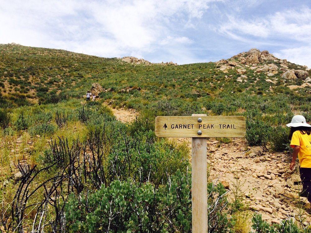
Garnet Peak Hike (2.3 Miles)
Laguna Mountain Recreation Area and Cleveland National Forest
This hike marries mountain and desert ecosystems—and provides a peak to summit without an overwhelming amount of distance or vertical climbing. If you start at the Garnet Peak trailhead, you can reach the peak in 2.3 miles with an elevation gain of about 500 feet. Or, if you want to start at the Penny Pines trailhead, you can hike four miles and take on an elevation gain of about 700 feet to get to the top.
Penny Pines takes you along a section of the famed Pacific Crest Trail and gives you a sweeping panorama of the desert near the beginning of the hike. “The final approach to the peak is the steepest part, but don’t worry, it doesn’t last long, and it is 100 percent worth the final climb,” Linke says. “The view from the rocky outcroppings at the top give you an unobstructed 360-degree vista of mountains to the north, south, and west and of the desert to the east … It’s quite amazing that you can bag a peak just an hour’s drive from San Diego.”
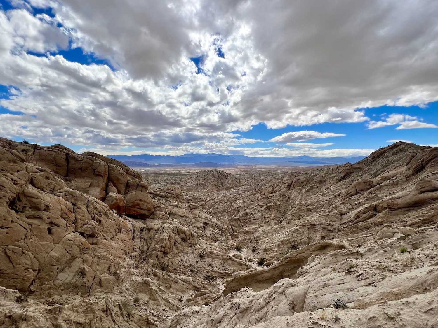
Truckhaven Rocks Hiking Trail (1.6 Miles)
Anza-Borrego Desert State Park
Linke says one of the best hiking trails in Anza-Borrego Desert isn’t really a trail at all. “Oddly, even though it feels completely off the grid, it’s clearly visible from the S-22 Highway, about a 10 minute drive outside of Borrego Springs,” he explains. “It’s called Truckhaven Rocks and it affords the confident hiker with amazing views of Vallecito Mountain to the south, Santa Rosa Mountain to the north, and Borrego Valley between them.”
Despite the path’s lack of official trail designation, you can find the map on the AllTrails app. Your hike will vary from two to three miles and the elevation gain will be determined by your interest in scrambling up rocks or dry waterfalls. This trail also features some short slot canyons, small wind caves, and evidence of rockfalls.
“You can probably guess by now that there won’t be a parking lot or trail signs, so use the AllTrails map or inquire at the visitor center for the best starting point,” Linke says. “You’ll need to park on the highway, but don’t worry, people do it all the time. While it’s an easy hike, it can be easy to get a bit turned around, so use some sort of navigation device. If all else fails, just keep walking north and eventually you’ll run into the highway.”
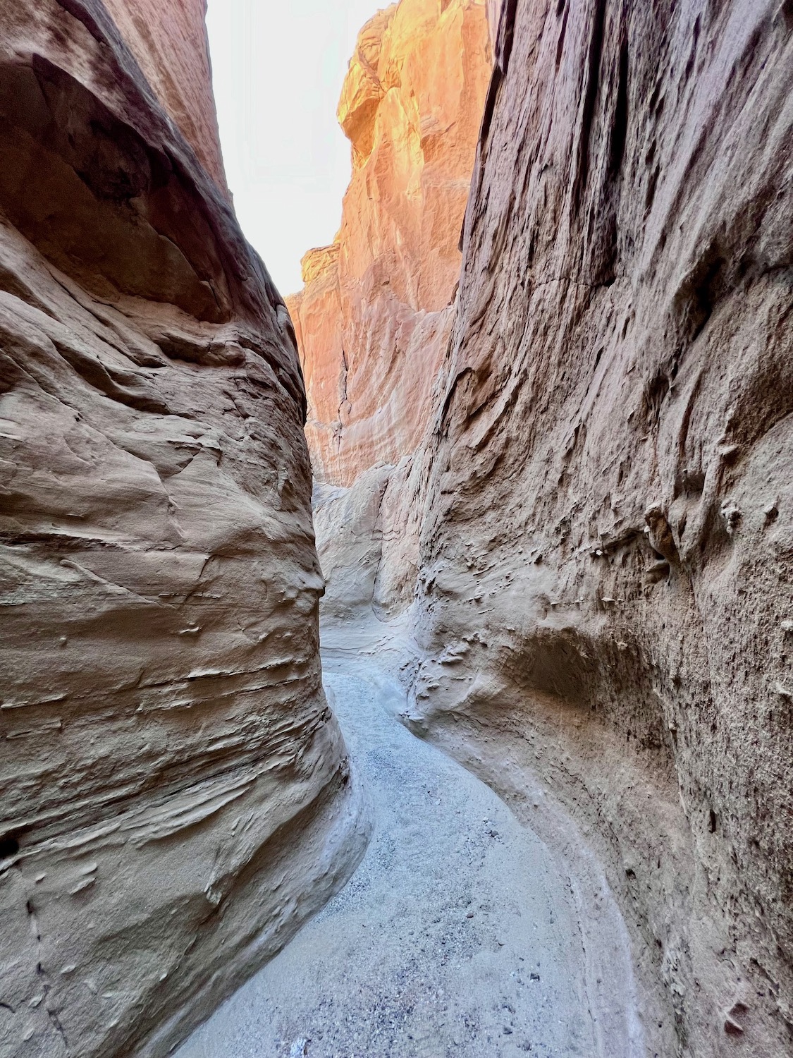
Palm Wash Hike (3.5 Miles)
South Fork, Anza-Borrego Desert State Park
This is a desert hike that is accessible from the highway, but you’ll feel like you’ve discovered a distant and beautiful place. To find the entrance, use the AllTrails app or get advice from the visitor center. The trek covers about three miles with an elevation change of around 500 feet.
“Once your hike begins, you’ll almost immediately be mesmerized by a large, tilting natural bridge,” Linke says. “Other fun and interesting features along the way include steep cliffs, dry waterfalls, evidence of rockfalls, and short but beautiful slot canyons. The hike will terminate at an overhanging dry waterfall, surrounded by tall sandstone formations … The great part about this hike is that as you retrace your steps, you’ll see the canyon from a whole new perspective, and it will seem like a brand-new and exciting hike.”
Claire Trageser has been writing for San Diego Magazine for 10 years. She also is a reporter at KPBS and writes for The New York Times, National Geographic, Marie Claire, Elle and Runner's World.
The inland North County community of Rancho Santa Fe is often associated with wealth. It’s one of San Diego’s most expensive residential markets and is consistently ranked one of the highest-income zip codes in California and the U.S. Rancho Santa Fe is known for its large equestrian community including riding facilities and horse trails, as well as its country club lifestyle and associated golf courses.
At the center of this luxury master-planned community is a small, walkable downtown area referred to as the “village,” with The Inn at Rancho Santa Fe acting as both a landmark and social hub. Much of the community, including the historic Inn, was designed by acclaimed architect Lilian Rice, one of California’s earliest female architects. The Spanish Colonial-style architecture she brought to the village is still one of its defining characteristics today.
Whether you’re coming to Rancho Santa Fe for golf, horseback riding, or pampering at a resort spa, be sure to start with a short walk around the village to take in the neighborhood’s charm. Plan your next visit here with our neighborhood guide to the area’s best restaurants, things to do, and shopping.
Rancho Santa Fe Restaurants, Bars, and Coffee Shops
The Pony Room
Families congregate at The Pony Room for elevated California ranch-style cuisine. Lamb lollipops, carne asada tacos, burgers, and weekly dinner specials are offered here, alongside an extensive collection of wine and spirits (especially tequila) and sizeable kids menus. As the signature restaurant of Rancho Valencia Resort & Spa, this all-day eatery is a lively centerpiece of the local social scene.
5921 Valencia Circle
Mille Fleurs
The piano bar at Mille Fleurs is the buzziest spot to be on Friday and Saturday nights in Rancho Santa Fe. French classics like escargot, lobster bisque, duck confit, and steak frites are the main dinner attractions at this local institution that has been around for more than 40 years. Spring for the four-course prix fixe menu before nabbing a coveted bar seat near the piano entertainer.
6009 Paseo Delicias
Nick & G’s Restaurant
Nick & G’s is one of the most prominent restaurants in the village, with an outdoor patio that overlooks the main thoroughfare. Enjoy modern Italian food, steaks, and seafood dishes here, including homemade pasta, pizza, wagyu beef, and oysters. Be sure to check their live music schedule and events calendar for the latest happenings.
6106 Paseo Delicias
Lilian’s
Named after renowned architect and planner Lilian Rice, Lilian’s is The Inn at Rancho Santa Fe’s flagship restaurant. Their upscale menus feature sustainable seafood, grass-fed meats, local produce, and even sushi rolls during dinner. Outdoor seating provides a bird’s-eye view of the village and an elegant backdrop for weekend brunch. Stop by Bing’s Bar (a nod to Bing Crosby) for craft cocktails, beer, wine, and light bites in a refined setting.
5951 Linea Del Cielo
Thyme in the Ranch
Quaint cafe and bakery Thyme in the Ranch serves a small selection of breakfast and lunch items (don’t miss the tarragon chicken salad), but is perhaps best known for its pastries and baked goods. Cakes, pies, muffins, scones, and cookies fly off the shelves here, where locals come for special occasions, parties, and group catering orders.
16905 Avenida De Acacias
Paseo RSF
Located inside a historic building once home to Rancho Santa Fe’s original schoolhouse, Paseo RSF is one of the village’s newest dining options. The charming American bistro has pasta, salads, burgers, meat and seafood entrees, plus a thoughtfully selected California wine list and new sushi and omakase program. Kids and dogs are both welcome here.
6024 Paseo Delicias, Suite C
Rancho Roasters
Grab a quick coffee to go from this walk-up window in the same shopping center as the post office. Cinnamon roll lattes, cold brew, spiced chai, smoothies, protein bowls, and more can be found at Rancho Roasters, where they brew beans from Dark Horse Coffee.
16950 Via De Santa Fe
Goli Pizza
Casual pizzeria and martini bar Goli is a popular spot for catching the latest sports games. Order one of their unique specialty pizzas like the Casbah with hummus and veggies, build your own pizza or burger, or go with one of their hearty wraps that’s made with an extra thin version of pizza dough.
18021 Calle Ambiente, Suite 403
Cocina del Rancho
Find generous portions of Mexican food at Cocina del Rancho, run by the same owners as Carlsbad’s Cicciotti’s Trattoria Italiana and Village Kabob. Get classic dishes like burritos, tacos, and enchiladas, plus their specialty items including pulpo, carne asada, and fajitas with lobster tail. Don’t skip the margaritas.
Kai Oliver-Kurtin is a San Diego-based writer who covers travel, dining, events, and culture. Her writing has been published in USA Today, Condé Nast Traveler, Fodor's Travel, Marie Claire, and HuffPost, among others.
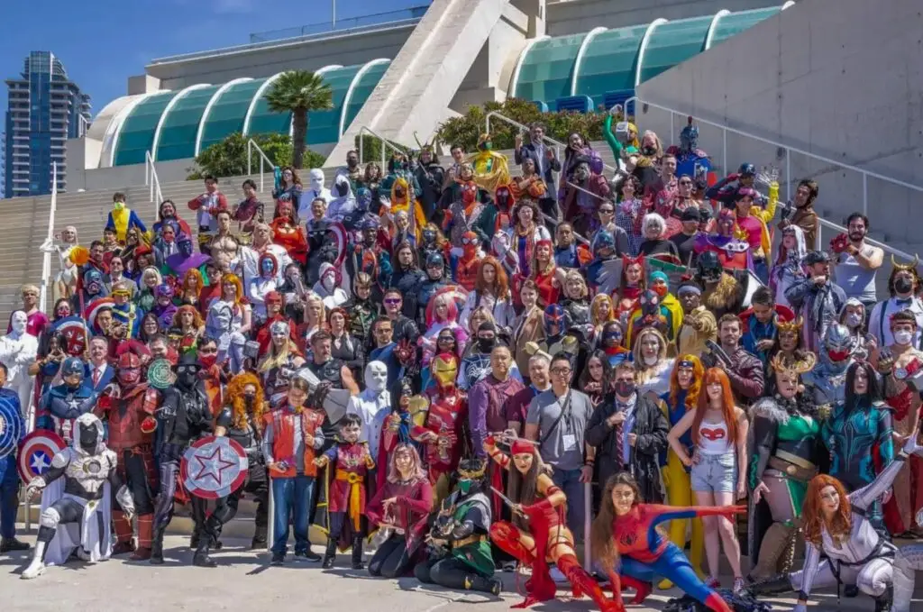
It’s happening, San Diego. The pre–Comic-Con excitement jitters begin to creep in as soon as July hits the calendar. But for those who forgot to set an alarm on registration day, whose batteries died or whose luck ran out in the virtual waiting room, or who simply prefer to soak up the fandom frenzy from the outside, we’ve got the best ways to experience Comic-Con weekend—no badge required.
Ready Party One: The Final Level 2026 SDCC Kickoff Party
Ain’t no party like an after-hours party, and XLE Productions’ Ready Party One is definitely one for comic book fans. Kick-start your convention weekend at Parq Nightclub and enjoy music by fan-favorite ’80s tribute band The Flux Capacitors, along with enough fandom fun, cosplay, retro gaming and pop-culture nostalgia to satisfy your inner geek. At least for the night.
Date & Time: Wednesday, July 22, 8 p.m. Location: Parq Nightclub, 615 Broadway, San Diego, CA 92101 Price: Tickets start at $34
Interactive Zone at Petco Park and Gallagher Square Events
With more than a dozen activities and brand activations, Petco Park’s Interactive Zone is a badgeless fan’s playground, bringing together brands, games, celebrity appearances and immersive experiences all in one place. On Friday, July 24, Funko’s beloved annual party, hosted by Funko founder Mike Becker, returns to Gallagher Square. This year’s “Quest for the Grail” event will take guests on a journey to the sunken city of Atlantis. Expect themed décor, food, drinks, games and special guest appearances.
Date & Time: Thursday, July 23–Sunday, July 26 (times TBD) Location: Lexus Premier Lot across from Petco Park Price: Free; Funko Funday event is ticketed
Cartoon and art lovers can celebrate the work of Chuck Jones, creator of some of animation’s most iconic characters, including Bugs Bunny, Daffy Duck, Road Runner, Wile E. Coyote and Pepé Le Pew, at Seaport Village’s Chuck Jones Gallery. During Comic-Con weekend, the showroom will also host meet-and-greets with talented artists including Disney artist and seascape painter Steve Barton, The Simpsons animator Stephen Reis, and licensed Warner Bros., Hanna-Barbera and Disney fine artist Ben Olson.
Date & Time: Thursday, July 23–Saturday, July 25, 2026 (times TBD) Location: Chuck Jones Gallery, 809 W. Harbor Drive, San Diego, CA Price: Free
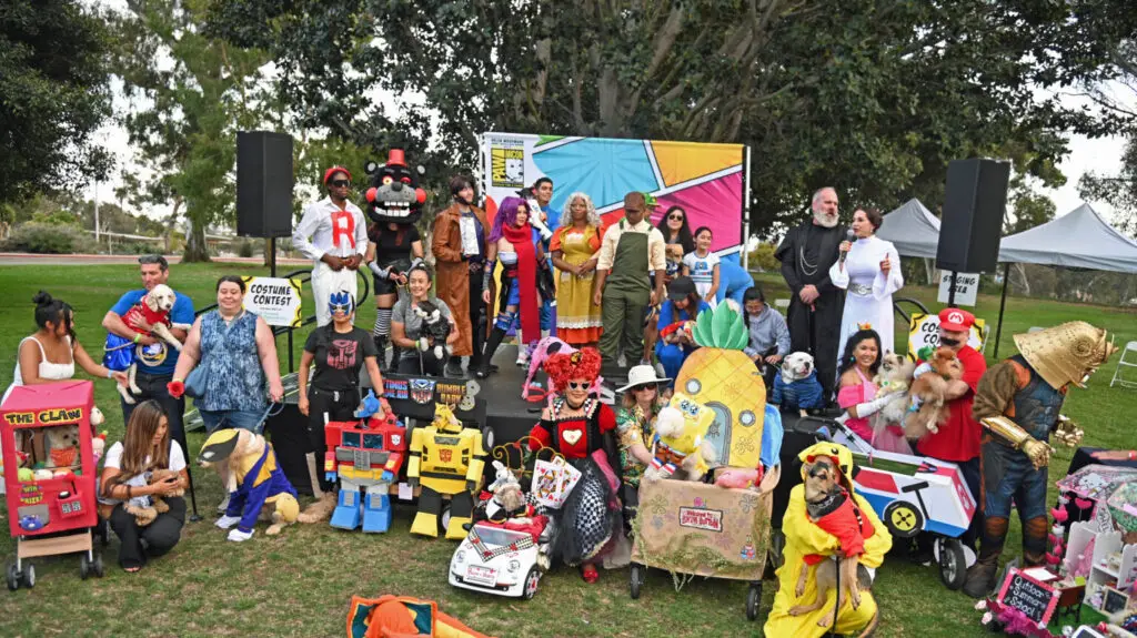
PAWmicon Pet Cosplay
Get your pup’s—and your own—cosplay game ready because Helen Woodward Animal Center’s PAWmicon is back. Enjoy a Comic-Con-themed outing with the whole family while raising awareness for orphaned pets in San Diego. Divided into three categories—Flying Solo, Dynamic Duos & Trios & More, and Fantastic Floats—the event is a paw-fect way to jump-start the festivities.
Date & Time: Tuesday, July 21, 2026, 4:30–7 p.m. Location: Presidents Way Lawn at Balboa Park Price: Free
Comic-Con-Themed Bar Crawl
Why leave all the fun, mischief and mayhem to badge holders when you can join more than 300 partygoers and crawl through some of downtown San Diego’s top bars and nightclubs? Whether you’re called to save the universe or have an allegiance to the dark side, the annual Comic-Con Bar Crawl gives attendees exclusive access to more than 20 venues throughout the Gaslamp Quarter, with free welcome shots, exclusive drink discounts and complimentary entry along the way. This event for ages 21 and older is a fun way to celebrate your fandom outside the convention center.
Date & Time: Friday, July 24–Sunday, July 26, 2026, 8 p.m.–2 a.m. Location: Check-in at Toro, 672 Fifth Ave., San Diego, CA 92101, from 8–9 p.m. Price: $13–$30
Her Universe Fashion Show
Geek out over couture at the annual Her Universe Fashion Show at the Manchester Grand Hyatt. Hosted by founder and Star Wars: The Clone Wars actress Ashley Eckstein and presented by Warner Bros. Discovery Global Consumer Products, this year’s show will feature a selection of designers showcasing one-of-a-kind DC-inspired creations as they compete for a $2,000 cash prize.
Note: Wristbands are traditionally distributed the morning of the event on a first-come, first-served basis, but official details have not yet been announced.
Date & Time: Thursday, July 23, 6 p.m. Location: Manchester Grand Hyatt, Seaport Ballroom, 1 Market Place, San Diego, CA 92101 Price: Free
Comic-Con Museum
A destination for all things fandom, Balboa Park’s Comic-Con Museum brings world-premiere and exclusive exhibits and events to the heart of San Diego, giving fans a place to geek out all year long. The museum is currently featuring the U.S. debut of Doctor Who Worlds of Wonder, showcasing 17 of the Doctor’s most iconic costumes, a full-size TARDIS and a collection of original sonic screwdrivers used on-screen. Visitors can also explore Sangre, Sudor y Mito: The Art and Tradition of Mexican Lucha Libre, featuring rare collectibles and authentic masks and costumes worn by legendary luchadores.
Date & Time: Open Thursday through Tuesday (closed Wednesdays), 10 a.m.–5 p.m. Location: 2131 Pan American Plaza, San Diego, CA 92101 Price: $15–$30; free for children younger than 6
Comic-Con Art Show
Browse an extensive collection of original drawings, paintings, jewelry and other whimsical creations from more than 100 professional and amateur artists at the Comic-Con Art Show. Many pieces will be available for purchase through the silent auction or Quick Sale, giving fans the chance to take home a one-of-a-kind Comic-Con souvenir while supporting talented artists.
Dates & Times:
Thursday, July 23: 11 a.m.–8 p.m.
Friday, July 24: 9 a.m.–8 p.m.
Saturday, July 25: 9 a.m.–6 p.m.
Sunday, July 26: 9 a.m.–6 p.m.
Location: Manchester Grand Hyatt, Grand Hall CD, 1 Market Place, San Diego, CA 92101 Price: Free
Looking for a supercute way to fuel your Comic-Con adventures? Swing by the Hello Kitty Café Truck. This traveling pink café on wheels will be parked at Petco Park’s Interactive Zone, serving up tasty treats and exclusive merchandise. From limited-edition tote bags and hats to mugs and T-shirts, it’s the perfect stop to grab a snack and a little extra kawaii cuteness.
Date & Time:
Thursday, July 23–Saturday, July 25: 10 a.m.–4 p.m.
Sunday, July 26: 10 a.m. (closing time TBD)
Location: Petco Park Interactive Zone, 100 Park Blvd., San Diego, CA 92101 Price: Menu items vary
PopUp Bagels, Spider-Man and Donut Bar Activations at Pendry San Diego
Get ready to fuel up and hype up. Whether you’re a plain-bagel purist or an everything-bagel fan, don’t miss your chance to grab breakfast or recharge at PopUp Bagels’ Volkswagen bus parked outside Pendry San Diego. Then satisfy your sweet tooth at Provisional with a rotating selection of character-themed doughnuts from Donut Bar. Both are available throughout the weekend beginning at 7 a.m. until sold out.
On July 24 and 25 from noon to 4 p.m., head to Nason’s Beer Hall for photo ops to celebrate Sony Pictures’ upcoming Spider-Man: Brand New Day. Guests can sample Tom Holland’s nonalcoholic beer brand, BERO, served in limited-edition themed cans available exclusively during the event.
Camila Ibarra Gallego is a CaliBaja native pursuing a master's degree in culinary journalism at the Basque Culinary Center. Shaped by the culturally rich, bicultural megaregion, she's passionate about sniffing out stories that connect people, territory and culture through food. When she's not tumbling down internet rabbit holes, you can find her pretending to be a wine connoisseur at a local wine bar or nose-deep in a good book.
When three nations and 16 cities come together to host the FIFA World Cup 2026, the scale stops feeling like a tournament and starts feeling like geography. A continent becomes the stage as borders soften into corridors. And Southern California—shaped by migration, sport, entertainment, and constant movement—sits inside that landscape with all eyes on it.
San Diego and Los Angeles have always felt connected. Hop on the Pacific Surfliner, and the trip unfolds in one continuous stretch of coastline, passing beach towns, neighborhoods, and city centers.
Traveling from San Diego, everything still feels slightly suspended as the Pacific Surfliner follows the coast north with ocean on one side and a slow suburban blur on the other. San Diego stays in exhale. Los Angeles is already building toward something louder.
This summer, Los Angeles will host eight matches of the FIFA World Cup at Los Angeles Stadium, including the US Men’s National Team opener on June 11, while the region stretches into 39 days of programming across stadiums, parks, transit hubs, beaches, and neighborhoods. Instead of one massive fan hub, Los Angeles is embracing a citywide celebration, with fan zones spread across its entirety.
But this pattern has been rehearsed here for decades. In 1994, Southern California became one of the defining stages of the World Cup, when matches at the Rose Bowl placed global attention on the region and turned local stadiums into international landmarks, confirming its ability to hold the world at scale.
What distinguishes Southern California is not just infrastructure, but cultural permeability. Fashion, music, film, art, and sport constantly overlap here, creating an environment where identity is flexible and always in motion. From the Venice boardwalk, where skate culture shaped modern street style, to global soccer stars rubbing shoulders with Hollywood celebs, to authentic Spanish cuisine moving up and down the I-5 corridor, everything circulates.
The World Cup is not introducing anything new here, it’s showing up for the summer and showing out, revealing what this city has always known about itself. What follows is a look at the fan zones and how Los Angeles turns itself into a city-wide stage for the tournament, one neighborhood at a time.
Courtesy of Los Angeles Tourism & Convention Board
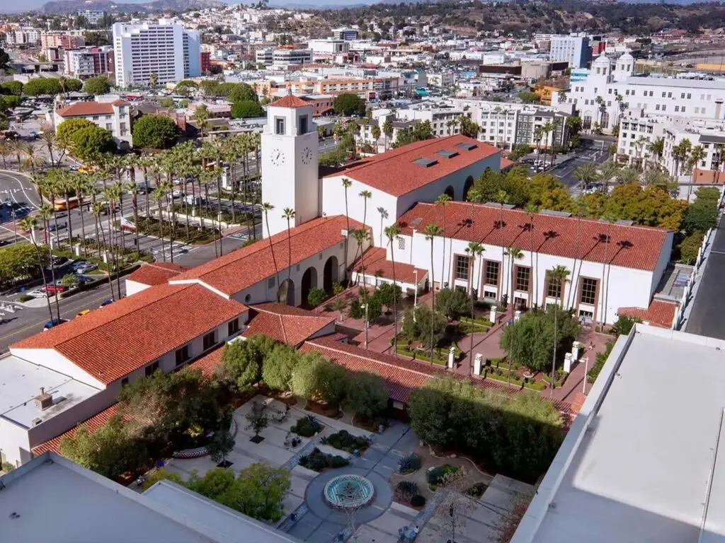
Los Angeles Union Station
As the heart of Los Angeles, Union Station is an official Fan Zone June 25-28 during the World Cup, but in practice it never really stops being one.
It is the city’s circulation point, its meeting ground, its pressure valve. Commuters, travelers, match-day crowds, and everyday Angelenos all move through the same space, and everything mixes, overlaps, and scales in real time. In a way, this is where the World Cup stops arriving in Los Angeles and starts moving through it.
The Pacific Surfliner from San Diego to Los Angeles makes that shift feel almost too easy. No stress or gridlock anxiety, just a straight line up the coastline with ocean on one side and everything slowly becoming more built on the other. It’s one of the rare ways into LA that doesn’t feel like arrival as friction. You can sit with a laptop, watch the Pacific drift past, grab coffee from the café car, and let the city come to you in pieces.
That’s the beauty of arriving at Union Station. Instead of feeling like you’re on the edge of the city, you’re immediately surrounded by it. And, inside, the station already reads like a World Cup nerve center: banners, movement, multilingual energy, the sense that something global is about to funnel through this exact point. The Heart of the City Fan Zone only sharpens that feeling, with simultaneous match screens, DJ sets, meet and greets, and immersive activations built around marquee games like USA vs. Türkiye.
ROW DTLA feels like the first exhale after arrival. A converted industrial campus turned creative district where restaurants, retail, and open-air courtyards form a self-contained ecosystem. If you’re looking for the perfect first meal in LA, make it lunch at Pizzeria Bianco. The thin-crust pizza is reason enough to go, but the space leaves just as much of an impression.
What I liked most about ROW DTLA is how quickly it resets you after the train. One minute you are stepping off at Union Station, and the next you are in a space that feels like its own version of LA, a city inside a city with some of the most curated shopping I’ve ever seen.
Bodega hides itself behind a convenience-store front, a sneaker and streetwear space disguised as something ordinary, like LA refusing to make anything feel too obvious. The whole campus moves like that, part retail, part gallery, part neighborhood you are only temporarily inside.
Isabella Dallas is a freelance writer for San Diego Magazine and the Arts and Culture Editor at The Daily Aztec in her final year at San Diego State University. She previously worked as an editorial intern for SDM, but when she’s not writing, you can find her trying the best coffee spots in SD, devouring the latest rom-coms, and indulging in anything and everything pop culture.
Entrepreneurs typically launch businesses because they’re passionate about a product or service, not because they want to manage its finances. While working to carve out a niche in their respective industries and drive their companies forward, many business owners find themselves bogged down by day-to-day accounting. Their existing accounting tools don’t provide the necessary visibility or insight, and they don’t have the time or resources to hire additional staff or a chief financial officer. That’s where NOW CFO comes in.
For more than 20 years, NOW CFO has been pairing businesses across the country with experienced accounting and finance professionals. Its outsourced model allows clients to customize solutions that match their individual needs, size, and financial challenges, whether that’s fractional or interim support, project-based services, or full-time placement.
NOW CFO’s clients range from startups preparing for rapid growth to established companies that need additional financial leadership without the commitment or expense of building an in-house team. However, many of these companies don’t fully understand their needs until they experience a “trigger” event: preparing for an acquisition or capital raise, navigating a first-time audit, or another period of transition. With a team of over 300 consultants nationwide, NOW CFO can start quickly and match the right expert to the right business.
“It’s important for companies to have financial visibility, and we can help them avoid a lot of the potholes that companies often run into,” says Mariah Block, a partner at NOW CFO’s San Diego branch. “Roughly half of our clients have an in-house finance person or department, and we’re resourced for more bandwidth when they need an extra set of hands at the staff or senior accountant level, or the controller or CFO level. Some clients use this a few hours a month and others use multiple people close to full-time. Our model is solution-based and customizable. We’re like a faucet you can turn on and off.”
With NOW CFO, there’s no one-size-fits-all approach. Solutions are based on the client’s individual goals, challenges, needs, and budget, meaning a client never pays for more than they need. Whether it’s a few hours of executive-level guidance or a full accounting team to support daily operations, NOW CFO meets businesses where they are and grows alongside them.
“We pride ourselves on providing our clients with the right resources at the right rate and being able to evolve as their needs evolve,” says Block.
And clients appreciate on-demand access to cost-effective support designed to improve performance and profitability.
Luxury car storage service Auto Concierge has partnered with NOW CFO to support growth over the past year. The arrangement began with a staff accountant who covered a leave of absence, but as the client’s needs changed, they also added a controller role. This allowed Auto Concierge to put effective processes in place and navigate operational challenges. Lori Church, Auto Concierge’s chief operating officer, says NOW CFO has been an “outstanding resource” and a “true strategic partner.”
“From the controller to the bookkeeper, every professional they’ve placed has brought a high level of expertise, responsiveness, and professionalism to our organization. Their team took the time to understand our business of high-profile clients and needs, adapted quickly to our fast-paced environment, and became a trusted extension of our team,” she says. “As Auto Concierge continues to grow, having a reliable financial partner like NOW CFO has allowed us to strengthen our financial and business operations while remaining focused on delivering exceptional service to our clients.”
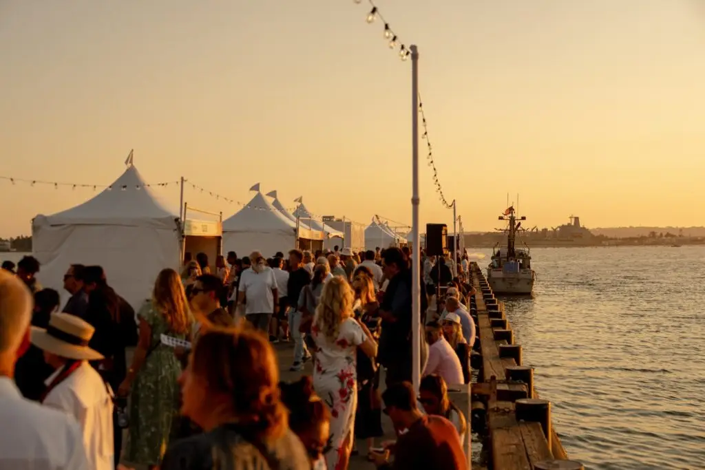
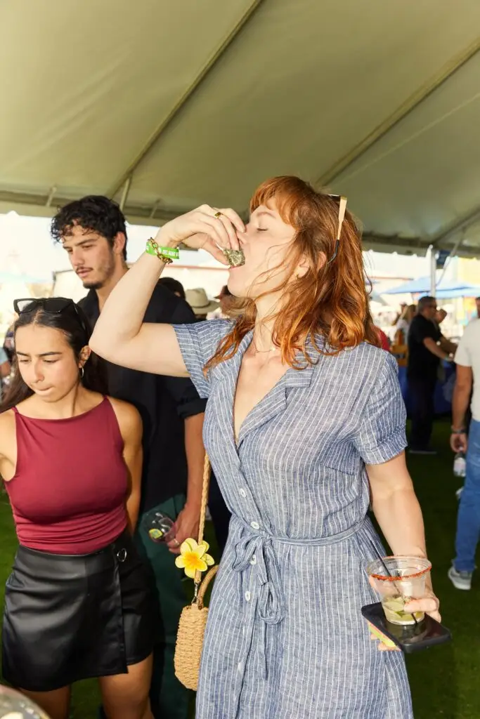
Maybe it was when Breaking Bad stars Bryan Cranston and Aaron Paul drank mezcal with chefs from San Diego and Food Network on the cliffs over Blacks Beach. Or the dinner outside under lights with Alex Morgan, celebrating some of the country’s most badass women chefs. Or the celebrity pickleball tournament hosted by NFL Hall of Famer Drew Brees, where the star of It’s Always Sunny in Philadelphia made thwacking sounds with locals. Or when Iron Chef winner Beau MacMillan commandeered (some say “stole”) a golf cart and delivered drinks and ice to chefs.
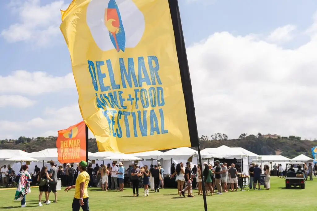
Whatever it is, Del Mar Wine & Food seems to have become the food and wine festival for people who don’t usually like food and wine festivals. The most San Diego thing.
Courtesy of Del Mar Wine & Food Festival
Two years ago, Thrillist named it one of the best food festivals in the country. Last year, 10,000 people came out to experience it, including Guy Fieri. Afterward, the founders spent a couple days trying to put their finger on why it felt so special. They had to name it, lean into whatever that was.
“It all came back to play,” says one of those founders, SDM co-owner Troy Johnson, a longtime San Diego food writer and Food Network judge. “Making world-class bread is serious, but breaking bread shouldn’t be. We gather all these incredibly talented people who take their craft very, very seriously—work their butts off all year to make some of the best food and drink in the country—and then we all just kinda play in the grass. We believe it’s possible to create something of incredible value and make the experience of that thing a laidback, easygoing, unpretentious experience. That’s what this is, and who we are in San Diego. The whole reason we did this was to shine a national spotlight on the people who make our food and drink culture hum.”
Courtesy of Del Mar Wine & Food Festival
The festival dropped its 2026 lineup today.
Headlining the fest are Food Network chefs Jet Tila, Maneet Chauhan, and Aarti Sequeira; Top Chef winner and Michelin-starred Buddha Lo; Iron Chef alum Beau MacMillan; MasterChef winner Kelsey Murphy; MasterChef Latinos winner Michelle Mathelin, chef and Guy’s Grocery Games judge Catherine McCord, chef and former Masterchef Mexico judge Benito Molina, Top Chef alum Jackson Kalb, Michelin-starred chef Drew Deckman, Michelin-starred chef Javier Plascencia, James Beard award-winning chef Brady Ishiwata Williams, and James Beard-nominated chef Mawa McQueen.
The party kicks off on Wednesday, September 30 at Monarch Ocean Pub with Signature San Diego, a walk-around tasting of the city’s greatest bites, from Baja seafood to bold Mexican flavors. From there, the energy carries into a celebrity pickleball tournament hosted by Drew Brees at Barnes Tennis Center on October 2, pairing friendly competition with an all-inclusive tasting experience in support of Feeding San Diego.
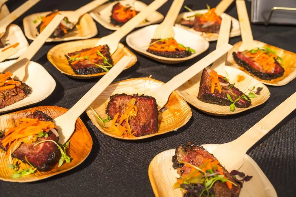
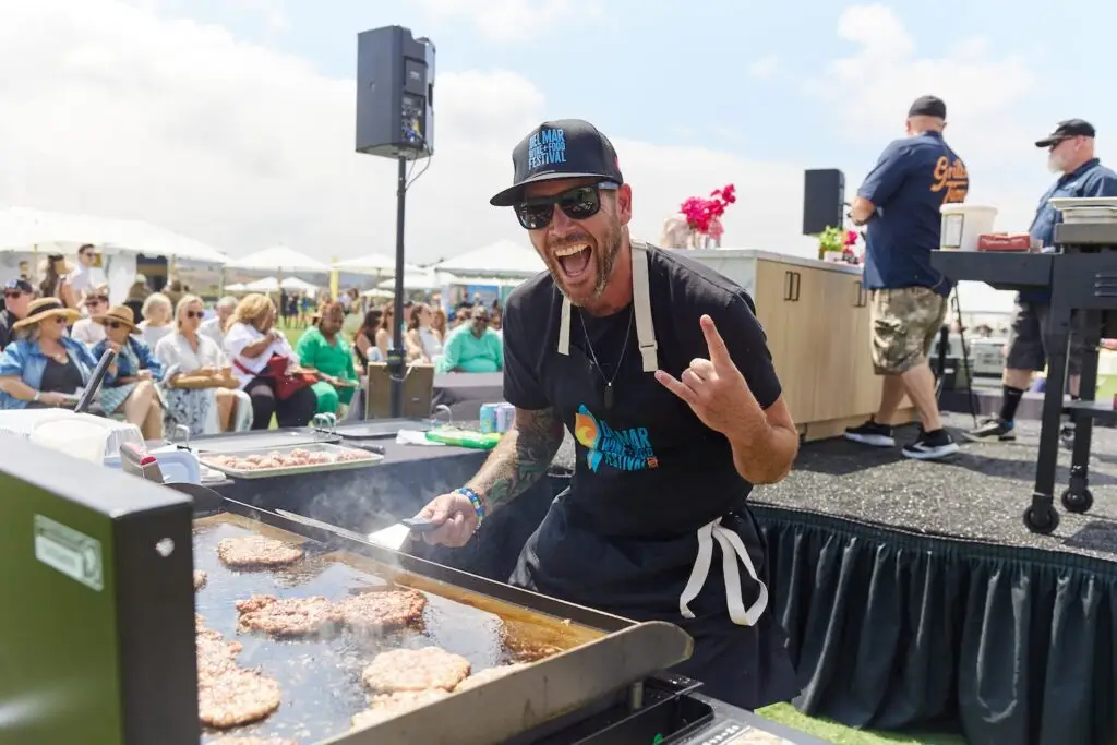
The main event is the two-day Grand Tasting at Surf Sports Park on Oct. 3 and 4. The city’s top chefs, food people from TV lands, and local tastemakers gather on the weirdly perfect grass to serve up everything from juicy Wagyu burgers and beef tallow fries to yellowtail tuna tostadas and veggies dressed up in their Sunday best. Wine and cocktail pairings are designed to round out the whole experience, including activations from Aperol Spritz, Hendrick’s Gin, Tequila Ocho, Mezcal Vago, Rioja wines, and Temecula producers.
Courtesy of Del Mar Wine & Food Festival
A VIP lounge offers exclusive access to curated small plates from Michelin-level chefs and pour from some of SoCal and Napa’s finest wineries and drink makers. The Official After Party at Guesthouse La Valle on October 3, a spirited walk-around tasting just steps from the Grand Tasting, where cocktails take center stage through imaginative bites inspired by the smoky, citrus-forward, and bittersweet flavors of classic drinks.
Zones return with activations including the Big Queer Food Fest celebrating queer chefs and queer-owned businesses; the Wellness Zone led by Novo Dia offering a built-in reset with non-alcoholic mocktails, movement-driven activations, and wellness-forward moments. Coastal lifestyle and locally made brands are also integrated throughout the festival.
“We are excited for the fourth edition of the Del Mar Wine & Food Festival this fall, which has quickly become one of the largest food and wine experiences on the West Coast,” says co-founder Chris Finn. “As the festival continues to grow, we are constantly looking to add events, experiences, and partners that will resonate with our San Diego community, and embody the Southern California way of life.”
Returning as the festival’s partner is local nonprofit Feeding San Diego. To date, Del Mar Wine & Food has raised $100,000 to support their ongoing fight against hunger across the region.
Stay tuned for additional events hosted by festival partners including Rob Machado, San Diego Wave, San Diego FC, Town & Country, and San Diego Mojo.
Courtesy of Del Mar Wine & Food Festival
Del Mar Wine & Food Fest: Frequently Asked Questions (FAQs)
When is the 2026 Del Mar Wine & Food Festival?
The 2026 Del Mar Wine & Food Festival will take place September 30–October 4 throughout San Diego County.
Where is the Del Mar Wine & Food Festival?
The week culminates with the Grand Tasting at Surf Sports Park (formerly the Del Mar Polo Fields) at 14989 Via De La Valle, Del Mar.
A wide variety of exclusive dinners, drink tastings, and other lifestyle events will be announced soon and available for purchase individually on Del Mar Wine & Food Festival’s website. These festivities include chef-curated dining experiences across San Diego’s hottest restaurants, a celebrity pickleball tournament, wine tastings, and more.
When is the 2026 Grand Tasting?
The Grand Tasting takes place this year on Saturday, October 3 and Sunday, October 4.
How much are tickets?
General admission for the single-day Grand Tasting starts at $185. An Early Access option is also available at $235, which includes an extra four hours before general admission to meet, mingle, and feast. For a two-day pass, General Admission starts at $275, while Early Access is $375.
VIP tickets begin at $425 for a single day, offering access to pre-festival experiences, exclusive food vendors, a dedicated VIP area, and more. For the full weekend in VIP, passes are priced at $765.
Where can I buy tickets for the 2026 Del Mar Wine & Food Festival?
Isabella Dallas is a freelance writer for San Diego Magazine and the Arts and Culture Editor at The Daily Aztec in her final year at San Diego State University. She previously worked as an editorial intern for SDM, but when she’s not writing, you can find her trying the best coffee spots in SD, devouring the latest rom-coms, and indulging in anything and everything pop culture.
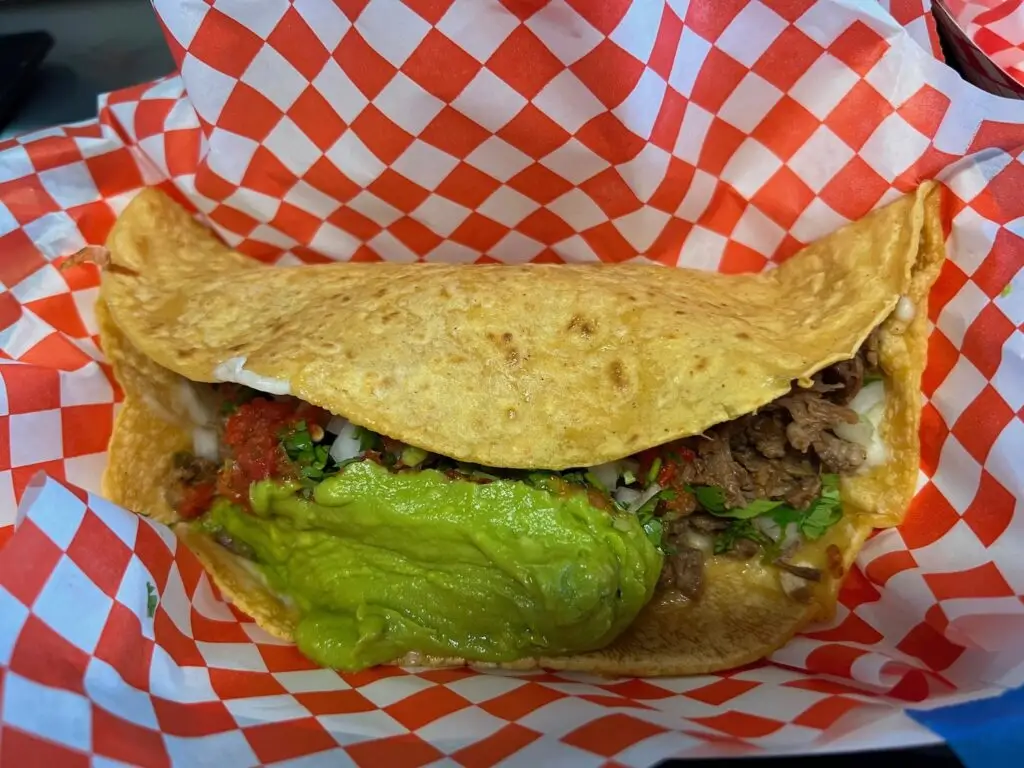
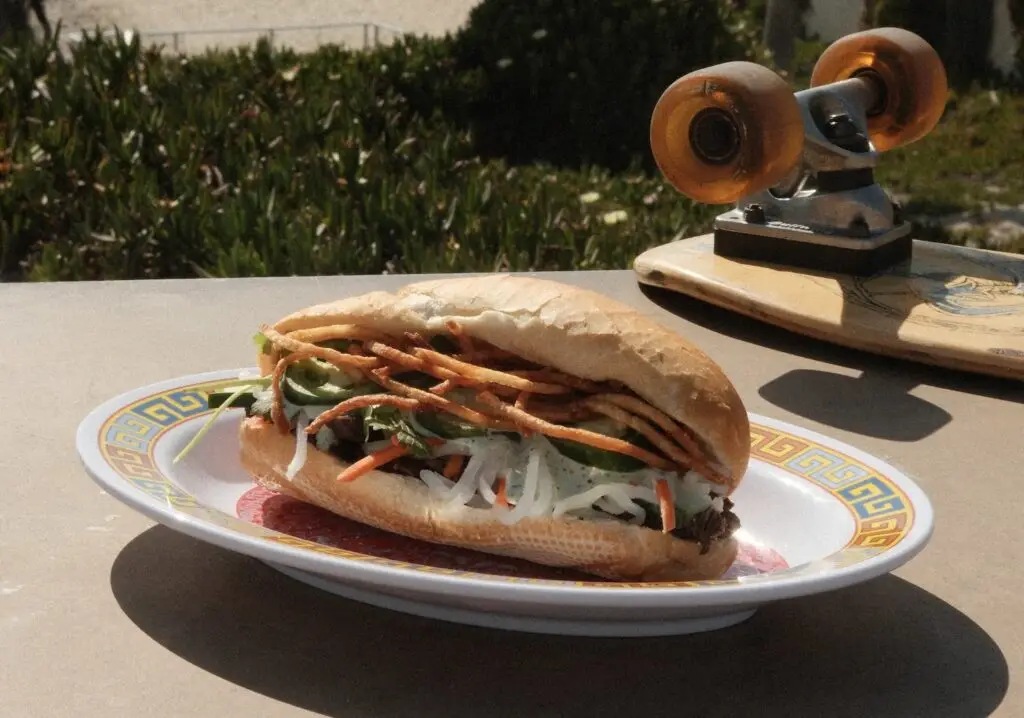
Is there any food more quintessentially San Diegan than the California burrito? That was a rhetorical question since the French fry-stuffed, flour tortilla-wrapped torpedo of carne asada bliss came into being in the 80s (either invented by Lolita’s or Santana’s, depending on who you ask). But now, Vietnamese-Mexican pop-up Một Bánh Mì may be giving the longtime champ a run for its money.
Một Bánh Mì’s original California banh mi takes cues from both cultures, using traditional Vietnamese baguettes from Paris Bakery filled with carne asada and garnished with cilantro-jalapeno crema, Vietnamese mayonnaise, pickled vegetables, cilantro, cucumber, jalapenos, and of course, French fries.
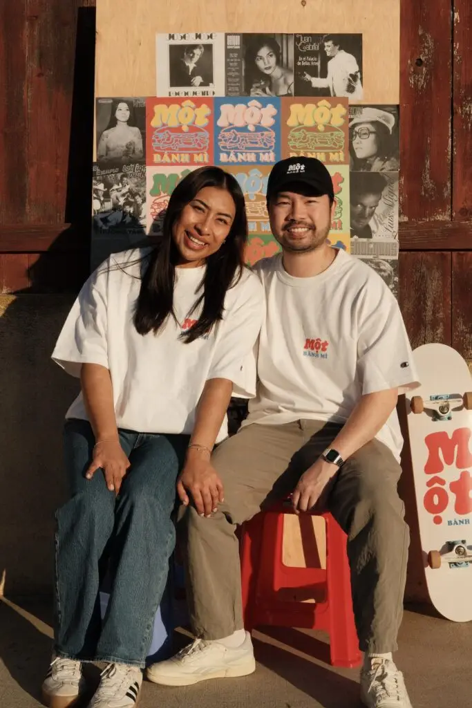
“It’s so San Diego—it’s so us,” says Desmond Bui, pop-up founder and owner with partner Marisol Santiago. “It really encapsulates the Vietnamese-American and Mexican-American journey and identity here.”
Both grew up in San Diego. Bui is Vietnamese. Santiago is Mexican-American. The sandwich makes utter personal sense.
Neither of them cooked professionally before launching Một Bánh Mì earlier this year, when they popped up for the first time at Convoy Rising for Lunar New Year. But after seeing the rise of the local Vietnamese coffee scene with shops like Saigon Coffee, Chance’s Coffee, and Em Coffee House, Bui knew there was an opportunity for a new generation to put a fresh spin on Vietnamese food in San Diego.
While there are plenty of places to grab a banh mi around town (K Sandwiches, Ba Le French Sandwich Shop, Lee’s Sandwiches, and so on), we’ve yet to hear of a California banh mi. Firsts are being firsted.
“Banh mi is regarded by top chefs as the best sandwich in the world,” says Bui. (Side note: I concur.) And after discovering overlap between Mexican and Vietnamese cuisines through common ingredients like cilantro, lime, jalapeno, white onion, and pickled vegetables, they began planning a menu.
Courtesy of Một Bánh Mì
Một Bánh Mì also serves Bánh Mì Đặc Biệt (Vietnamese cold cuts), Bánh Mì Thịt Nướng (grilled lemongrass pork banh mi), and Bánh Mì carnitas de hongos (mushroom pâté banh mi), along with some specials like Thịt Nướng tacos (grilled lemongrass pork) and hopefully soon, al pastor trompo banh mi (marinated pork shaved off a spit) and charcoal-grilled adobada.
Other banh mi shops Americanize names for English-speaking audiences—for example, listing “grilled chicken sandwich” instead of Bánh Mì Gà Nướng. Not Một Bánh Mì. If you’re not sure how to pronounce something, Bui says they’re happy to help. It’s an educational opportunity, he explains, as well as a chance for them to be “unapologetically Vietnamese and Mexican.”
Part of the immersive experience is playing Vietnamese tunes from the ‘60s and ‘70s.
“When you think of universal languages, what are ways when you travel or meet a different group of people that you can still find common ground and connect and feel like we’re a lot more alike than we are different?” Bui asks. “Food and music.”
The musical element is part of Một Bánh Mì’s greater vision. They’d like to evolve into a lifestyle brand and media company, with merch, jars of pickled vegetables, you name it. Eventually, they’d like to open a brick-and-mortar somewhere in Mid-City. In the meantime, they’ll continue to pop up at places like Mixed Grounds and Chance’s Coffee, or wherever they can. (Bui called Provecho Coffee their “dream collab,” hint hint.)
San Diego bartenders have been making serious waves over the past few years, and it looks like 2026 is carrying on that momentum. Dominique Muñoz, bar lead at Polite Provisions, just nabbed a top spot on Punch’s Best New Bartenders 2026 list. She’s hardly new to the game, having been behind the stick for nearly a decade and founding the Sirens and Spirits collective to elevate women and nonbinary bartenders in the industry, but it’s fabulous to see some (well-deserved) San Diego representation on the short list. Congrats to Muñoz—we can’t wait to see what you do next.
Speaking of awards, Tribute Pizza just earned a prize of its own. The North Park pizza palace hit #38 on the 50 Top Pizza list this year (for the fourth year) right before its 10th anniversary on June 2. Here’s to another decade of delightful pies, ridiculously good Caesar salads, and the weird-to-have, but delicious-to-eat Sichuan spicy noodles.
But the recognition doesn’t stop there. San Diego’s only three-Michelin-starred restaurant Addison by William Bradley (which is freshly re-open after a thorough renovation) just made San Diego history by being the first restaurant in the city to make it on North America’s 50 Best Restaurants 2026 list at #31. Considering there are something around 70,000 restaurants in North America (if not more)—I’d say landing in the top 50 is pretty monumental.
San Diego has one of the highest concentrations of people in the African diaspora, including one of the nation’s largest East African populations behind Minneapolis and St. Paul, Minnesota. To celebrate the huge diversity of cuisines from countries like Somalia, Eritrea, Ethiopia, and beyond, head to the annual San Diego Soul Food Fest on August 1 at the North Park Mini Park from 11 a.m. to 4 p.m. Soul food’s roots come from the American South, where generations of enslaved people made do with what resources they had; today, it’s a celebration of culture, cooking, and community. I, for one, am salivating at the thought of getting some legit collard greens and fried catfish.
In lieu of catfish, I just might pop over to Bica in Normal Heights on June 20 for the Tuna Takedown, where chefs from Kingfisher, Mabel’s Gone Fishing, Ironside, À L’ouest, Fish Guts (plus a few more) will go full nose-to-tail on a 150-pound bluefin tuna. That’s about as fresh as it gets, and with beer, wine, and a DJ on top of that, I’m hard-pressed to make any other plans that night.
Listen Now: The Latest in San Diego’s Food and Drink Scene
Have breaking news, exciting scoops, or great stories about new San Diego restaurants or the city’s food scene? Send your pitches to [email protected].
Beth Demmon is an award-winning writer and podcaster whose work regularly appears in national outlets and San Diego Magazine. Her first book, The Beer Lover's Guide to Cider, is now available. Find out more on bethdemmon.com.
National Philanthropy Day, presented by PNC Bank, Celebrates the Best of Philanthropy in San Diego
The 53rd Annual National Philanthropy Day Takes Place on November 21. Join us from 11:00 a.m. – 1:30 p.m. at the new Gaylord Pacific Resort & Convention Center!
Once yearly, AFP San Diego joins with others worldwide to celebrate National Philanthropy Day (NPD), a special day set aside to recognize the great contributions of donors and nonprofits that enrich of our community and the world. San Diego’s NPD is one of the largest and most successful in the U.S., attracting nearly 900 participants, including philanthropists, nonprofit leaders, CEOs, board members, development professionals, and business, community, and civic leaders.
Sponsorship proceeds from National Philanthropy Day are reinvested in education, training, scholarships, career development, and the advancement of fundraising professionals throughout San Diego. These resources and training provide fundraising professionals with the tools necessary to support our region’s diverse array of nonprofit organizations, which rely on charitable giving for close to half of their annual revenues.
The National Philanthropy Day Honorees are selected by the NPD Honorary Committee, a group of highly respected, diverse nonprofit and business leaders. Our 2025 Honorees include:
Outstanding Development Emerging Leader – Taylor Thompson Self-Nominated
Outstanding Development Professional – Sharyn Goodson Nominated by: AJ Steinberg & Jeanne Schmelzer
Outstanding Organization for IDEA – Accessity Self-Nominated
Outstanding Philanthropic Institution – Life Science Cares San Diego Nominated by: Blair Search Partners
Outstanding Philanthropist – Dan & Phyllis Epstein Nominated by: CSU San Marcos & KPBS
Outstanding Student Volunteer – Camden Hall Nominated by: Curebound
National Philanthropy Day San Diego provides an opportunity to reflect on the meaning of giving and to celebrate the selfless contributions of individuals and organizations across the region. We look forward to celebrating with you!
Sponsorship opportunities and individual tickets are available. Please visit www.afpsd.org for more information.