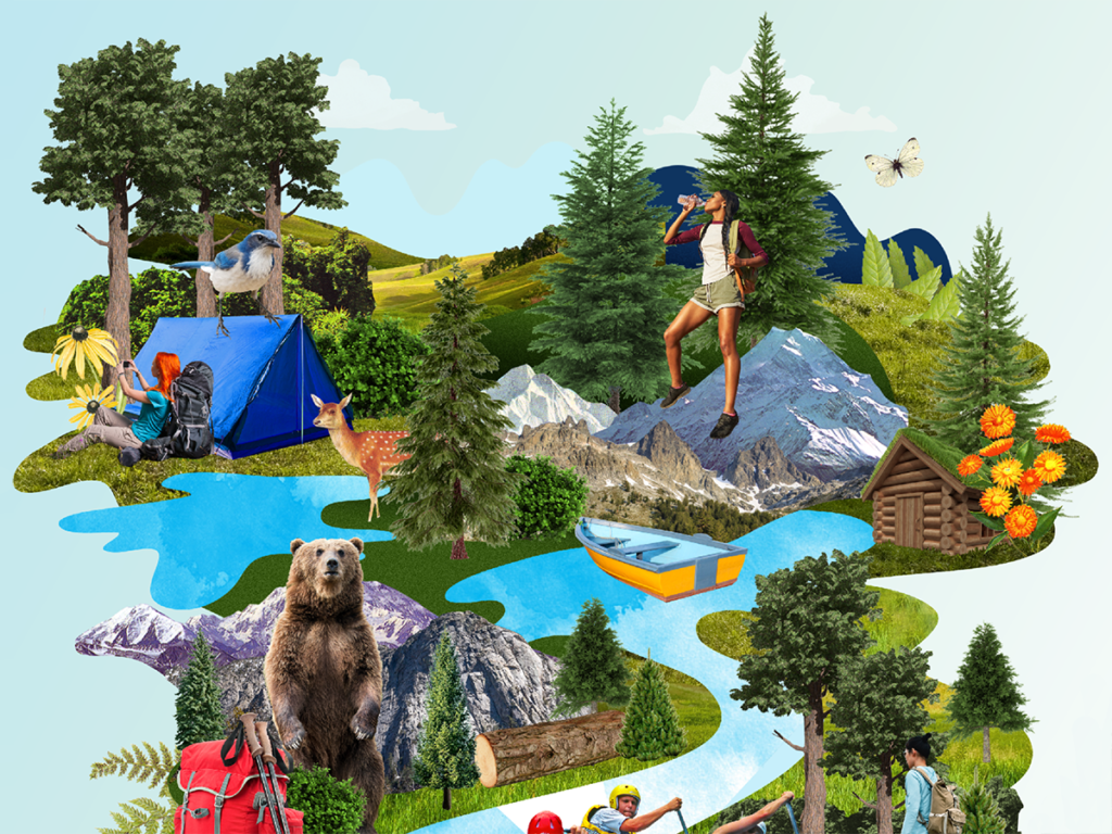
CHOOSE YOUR ADVENTURE TERRAIN:
Coastal || Mountain || Forest || Desert

Visit a Seldom-Seen Slice of the Coast
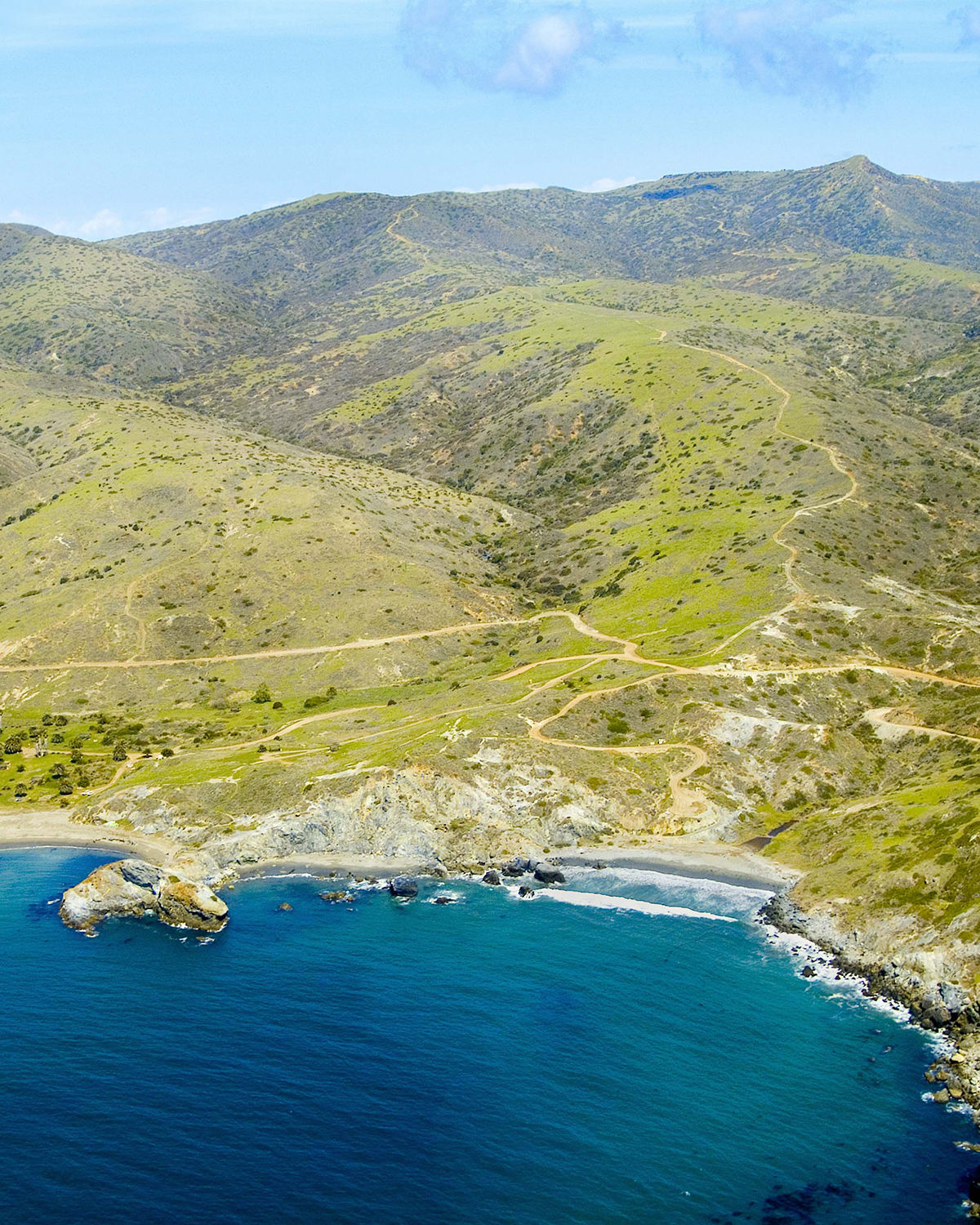
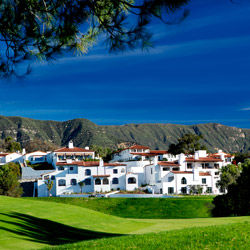
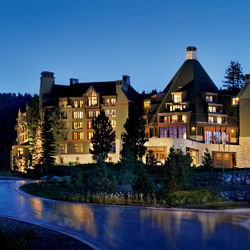
California Adventure Bucket List / Catalina
Catalina Island Company
Place
Little Harbor, Catalina Island
Season
Year-round, but
try to avoid
extreme heat
Distance
One hour by car to Dana Point, then
one hour by ferry
Bragging Rights
Earning an unusual and unforgettable view
Vibe
Deserted island (but with running water)
Good to Know
You can take a bus back to Avalon
Catalina Island’s camel-hump spine is a familiar sight on the horizon. But most will never lay eyes on the island’s far shore, the one you can’t see from the mainland. The most gratifying way to reach it is by foot from Two Harbors. A seven-mile trail ascends 1,200 feet as it climbs a ridge and takes you over the rugged interior, granting an airplane-window view of California. Winding down the other side, the trail skirts the cliff top, blue-green seas lapping below. Finally, the clustered palm trees of Little Harbor appear like an oasis. After the hot, dry hike, cooling off in the calm waters of the cove is the perfect way to take in this beautiful hidden coast.
As of May 31, the Little Harbor campground is open. Visit reserveamerica.com for reservations or call 877-778-1487.
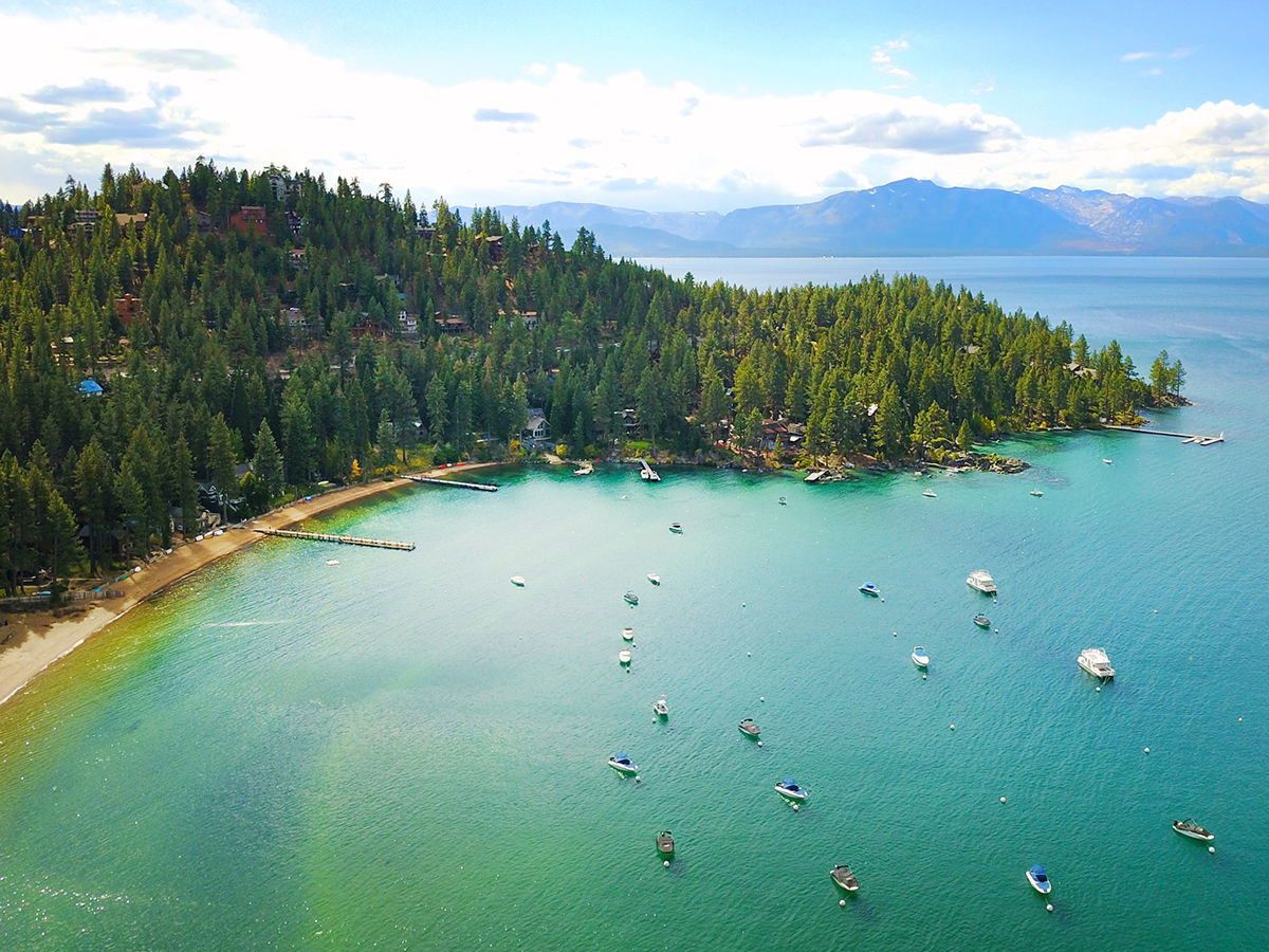
California Adventure Bucket List / Lake Tahoe
Boat-In Camping on Lake Tahoe
Place
Emerald Bay State Park, Lake Tahoe
Season
Summer
Distance
Nine to 10 hours
by car; or fly two hours to Reno or Sacramento and then drive
Bragging Rights
Staying at the only boat-in campground on the lake
Vibe
Whiskey bottle? Cast iron pan? Sure, toss them in the boat.
Good to Know
This campground fills up quickly
As the largest alpine lake in North America, Lake Tahoe provides unlimited adventure potential. Yet it has precisely one boat-in campground: a mere 20 sites on the north shore of the rugged Emerald Bay State Park, near South Lake Tahoe, open only during summer. You can slip into the crystalline water anywhere, but most launch at D.L. Bliss State Park and make the four-mile paddle around Emerald Point. Lucky—or smart—campers will select one of just three tent sites at the campground with its very own bayfront beach where you can pretend the lake belongs to you alone. Early morning hours, before strong winds kick up, is the optimum time to explore the nearby Fannette Island and scan the treetops for bald eagles.
The park is closed through June 21, 2020. Visit reservecalifornia.com for updates.
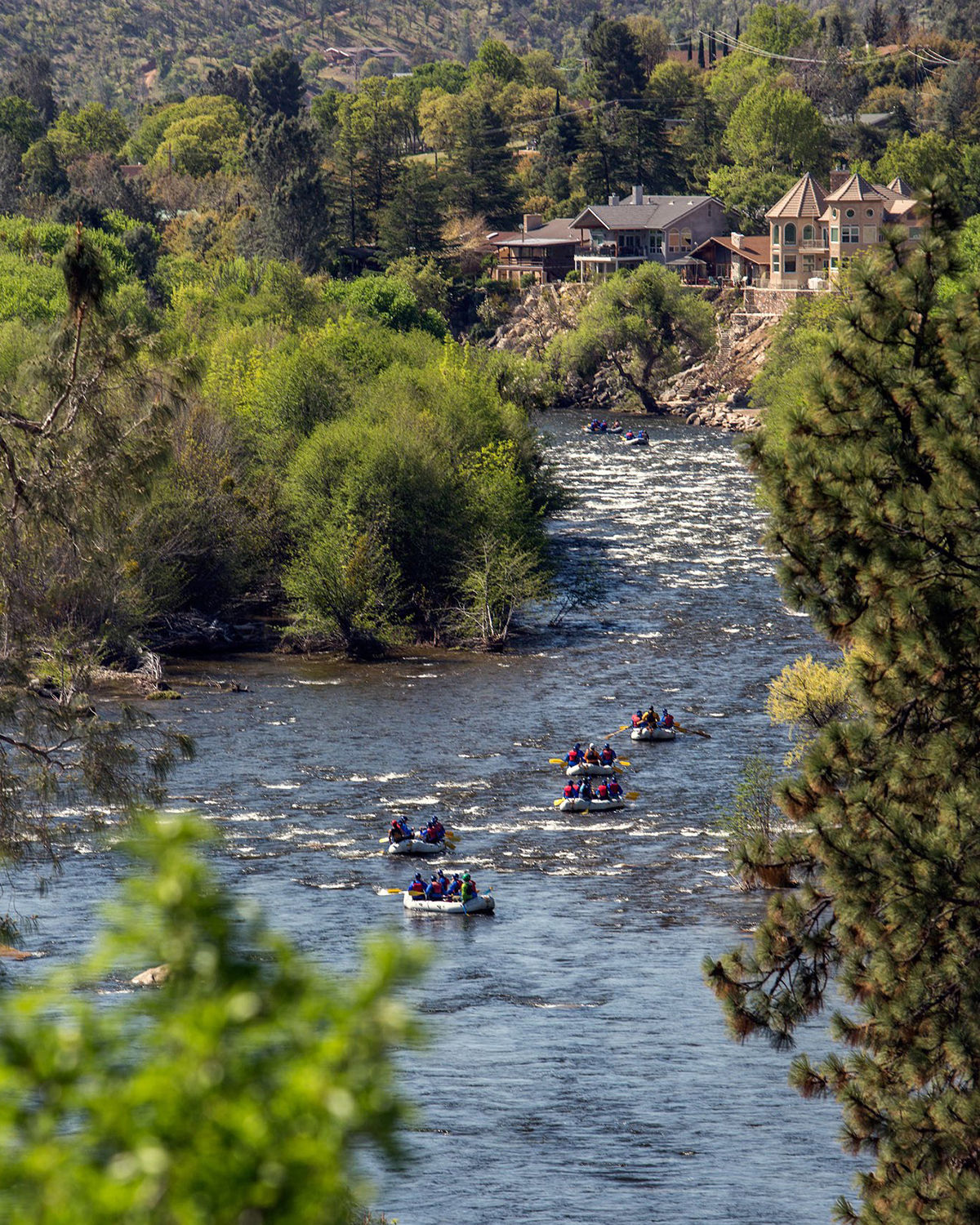
California Adventure Bucket List / Kern River
Kern River Outfitters
Raft a Wild River
Place
Kern River
Season
Spring and summer
Distance
About five hours by car; north of Bakersfield in Kern County
Bragging Rights
“Killer Kern” rapids are the stuff of legend
Vibe
Like summer camp, but the singalongs are voluntary
Good to Know
The Upper Kern is a serious outing; the Lower Kern more chilled out
Snowmelt from the lofty flanks of Mount Whitney plunges toward the southern Sierra town of Kernville to form one of the steepest rivers on the continent. The violent flow is untouched by humans until it hits the Fairview Dam (11,000 feet lower than Whitney’s summit). The National Park Service designated it a Wild and Scenic River, and the freeflowing nature of the 20-plus-mile stretch above town earned it the nickname “Killer Kern.” For maximum thrills, show up between March and July for a full-day outing to ride some rubber on this section, known as the Upper Kern. Be ready for notorious rapids like Joe’s Diner and Betty’s Bakery. And when the raft guide yells for you to paddle, paddle like you mean it.
Outfitters and tour companies are not operating until the end of June. Visit kernrafting.com for updates.

Climb One of California’s Only “Iron Paths”
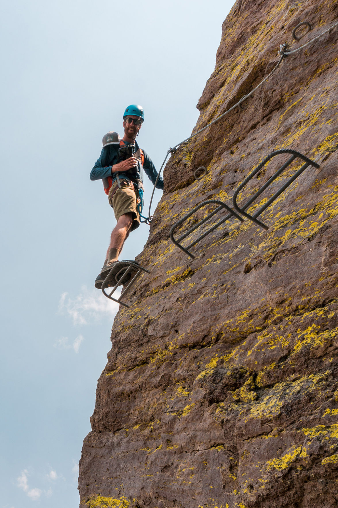
California Adventure Bucket List / Mammoth Mountain
Place
Mammoth Mountain
Season
June through September
Distance
Seven hours by car
Bragging Rights
Unparalleled views of the Eastern Sierra
Vibe
Mildly taxing, each at their own pace
Good to Know
They outfit you with a helmet, harness, and special shoes; all climbs are guided
A via ferrata, Italian for “iron path,” is a climbing route that uses permanent steel cables and metal rungs fixed into the mountainside, letting climbers in harnesses latch on for safety as they traverse. They date back to World War I and are common in Europe, but California had just a single example until a new one opened at Mammoth Mountain last year. To tackle Mammoth’s via ferrata, which is easily accessible by gondola, book a three-hour tour at the Adventure Center in Mammoth Village ($99 on weekdays; $119 on weekends). The six different routes have something to offer adventurers of all fitness and ability levels, though participants must weigh less than 264 pounds. Switching between sheer cliff and flatter, walkable areas, including a breathtaking suspension bridge, the routes ascend 180 feet and span over 300 feet of craggy cliffside. A heart-pumping thrill, this activity will impress pretty much any fun-hungry visitor looking for a new way to take in the mountains, and all necessary equipment is provided by Mammoth. The courage, though, you’ll need to bring yourself. —BRENT CRANE
Currently closed. Visit Mammothmountain.com for updates or call (800) 626-6684.
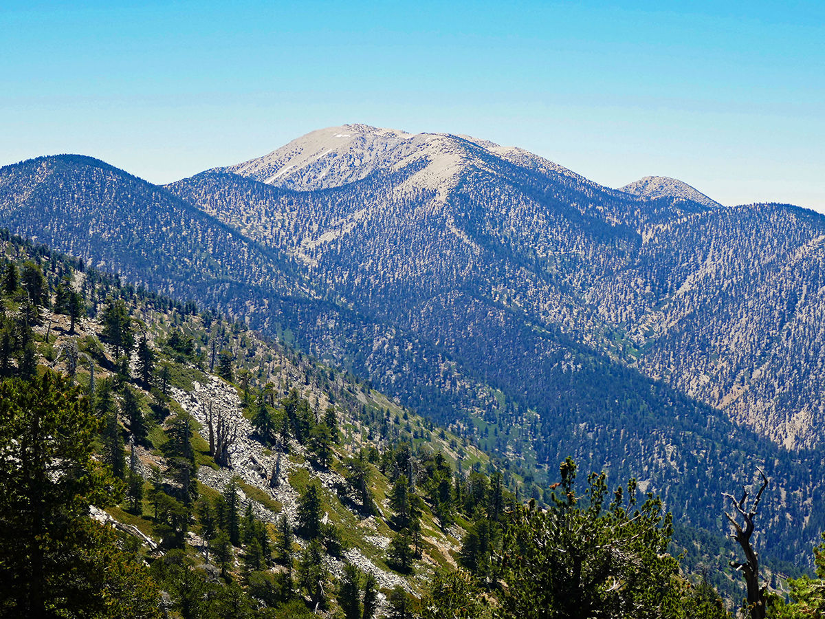
California Adventure Bucket List / San Gorgonio Mountain
Tackle Southern California’s Highest Peak
Place
San Gorgonio Mountain
Season
Summer and fall
Distance
Two hours by car; near San Bernardino
Bragging Rights
Reaching the highest point south of the
Sierra Nevada
Vibe
Grueling.
Worth it? Duh.
Good to Know
Start training
those legs now
The superlative to chase here is Southern California’s highest point, the 11,500-foot San Gorgonio Mountain, south of Big Bear. The rounded cap of “Old Greyback” is not conquered without a Herculean effort of the quadriceps, however. Ticking this off your to-do list requires climbing 5,500 feet over more than nine miles, via Vivian Creek. And that’s just the way up. Many hikers split up the outing by camping above 9,000 feet and summiting on day two. The steep trail maintains its pitch over the distance, meaning you’re going to earn every inch, especially considering that altitude takes a toll up here. Near the summit is a primitive rock shelter, in case you want a respite from the gusts that often accompany the dizzying views from the top.
Both the San Gorgonio and Vivian Creek trails are open. Visit fs.usda.gov for updates.
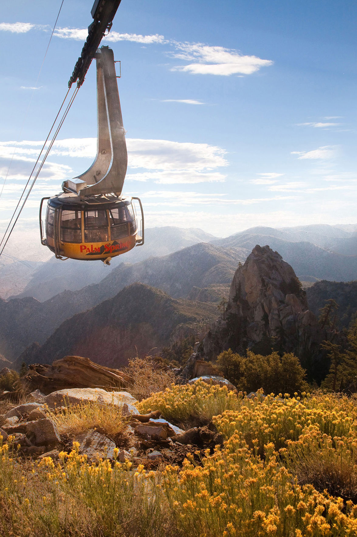
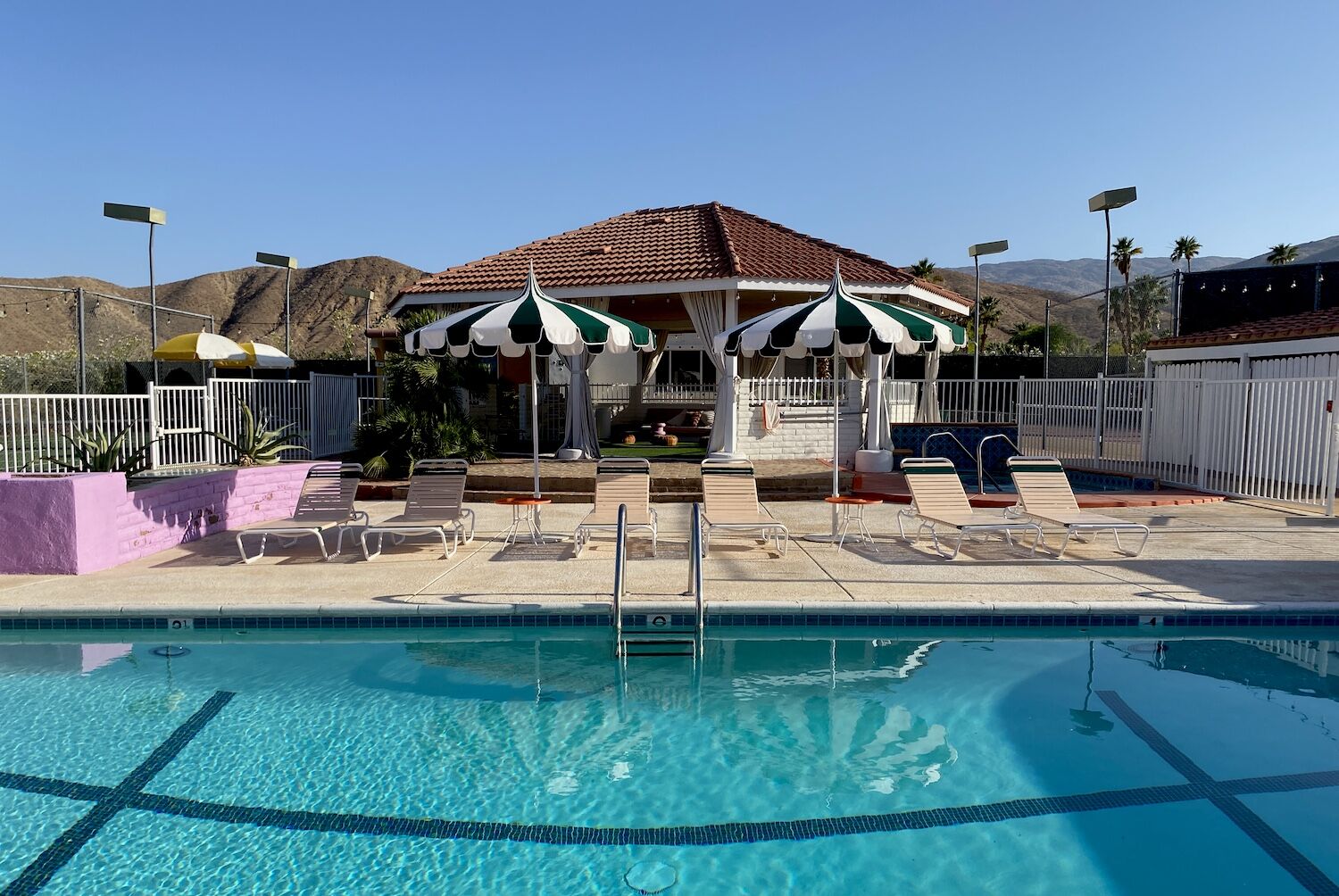
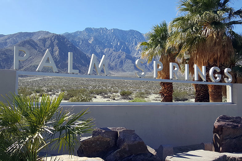
California Adventure Bucket List / Palm Springs
Palm Springs Aerial Tramway
Summit a Mountain Sitting Down
Place
Mount San Jacinto State Park and Wilderness Area
Season
Year-round
Distance
Two hours by car; near Palm Springs
Bragging Rights
Go from desert to alpine quicker than you can say, “Where did I put my beanie?”
Vibe
Sticking your head in the freezer on a hot day
Good to Know
Skis and snowshoes are available at the top
Forget winding mountain roads. The Palm Springs Aerial Tramway ascends an astounding 8,500 feet from the blast-furnace temps of Coachella Valley to an alpine environment a good 40 degrees cooler. The 10-minute, 2.5-mile ride is memorable in itself, but once your ears have popped, you have a bevy of options for exploring the surroundings. Among the granite boulders are 50 miles of hiking trails, two restaurants, a cocktail lounge, and views you’d normally have to work much harder for. But why stop here when you’re a stone’s throw (okay, 5.5 miles and 3,000 vertical feet) from Southern California’s second highest summit: 10,800-foot Mount San Jacinto. Attack it in one long day or camp in Round Valley for a more leisurely summit bid with added time to savor the surroundings.
The Palm Springs Aerial Tramway is closed, the nature trail at the park is open. Visit parks.ca.gov for updates or call (951) 659-2607.

Catch a Trout in a Backcountry Lake
Place
Onion Valley, Inyo National Forest
Season
Summer
Distance
5.5 hours by car; east of Fresno, near Kings Canyon National Park
Bragging Rights
Claim you caught oodles of trout; no one will be there to dispute it
Vibe
The Eastern Sierra’s famed fishing, all to yourself
Good to Know
Keep an eye out for California bighorn sheep
The high-altitude basin between Kearsarge Peak (12,600 feet) and University Peak (13,500 feet) is an Ansel Adams–esque landscape of stunted trees and sun-sculpted snow. Hikers hoof it up here from the 9,000-foot Onion Valley trailhead (a 13-mile drive from the town of Independence) to lay eyes on the picture-perfect Kearsarge Pass. Others come for the string of sparkling alpine lakes found between the trailhead and the pass (4.5 jaw-dropping miles). Connected by multiple cascades, they present ample places to angle for rainbow, brown, brook, and Alpers trout. Whether they’re biting or not, you’ve probably already landed one of the top fishing experiences of your life.
The campsite is currently closed. Visit recreation.gov for updates.
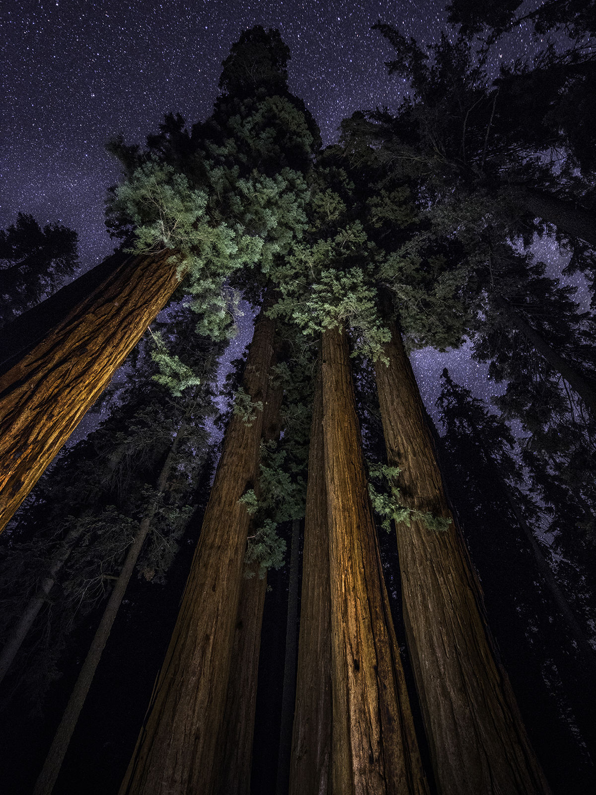
California Adventure Bucket List / Sequoia
Austin Trigg
Find Solitude among Giant Sequoia Trees
Place
Road’s End, Kings Canyon National Park
Season
Year-round
Distance
Six hours by car; east of Fresno
Bragging
Rights
Seeing the tallest trees in the world
Vibe
Humbling
Good to Know
Get there before the Yosemite crowds discover it
Not every bucket list goal needs a tangible achievement like bagging a summit, catching your dinner, or braving the forces of nature. Equally worthy is the pursuit of peaceful moments among natural splendor—the kind you might find beneath the canopy of the largest trees on Earth. There’s nowhere better suited to communing with giant sequoias than in Yosemite’s less-mobbed little brother, Kings Canyon National Park. From mountaintop to valley floor, the 8,200-foot elevation difference is greater than any found in the Grand Canyon. There are granite peaks, meadows, and waterfalls to explore. At Road’s End, a rock named for John Muir forms an idyllic swimming hole. And in the endless groves of colossal trees, unlimited intangible treasures await.
The park’s roads are open, but all campgrounds, visitor centers, restaurants and facilities are closed. Visit nps.gov for updates.
California Adventure Bucket List / Alpine Lake
Geminai Photography
Camp on an Alpine Lake
Place
Cottonwood Lakes, Inyo National Forest
Season
Summer and fall
Distance
Five hours by car to Lone Pine, Inyo County
Bragging Rights
Hiking to waterfront lodging
Vibe
All the splendor of the High Sierra
Good to Know
Prepare for icy water if you want to take a dip
The fun begins while you’re in the car, navigating the hairpin switchbacks—and 6,000 feet of elevation gain—on Horseshoe Meadows Road, in the Eastern Sierra outside of Lone Pine. Then at 10,000 feet in a forest of lodgepole pine awaits the Cottonwood Lakes trailhead, where you pack a bear canister (required) and lace up your hiking shoes. Little climbing is necessary on the six-mile path, which follows meadows and creeks before reaching the sparkling Long Lake, sculpted by granite at 11,000 feet. There would be nothing wrong with staying put, casting for golden trout, and watching the light and shadows in this cirque. It’s also a perfect base camp for the 14,026-foot summit of Mount Langley (one of a dozen “fourteeners” in California).
Cottonwood Lakes trailhead is closed. Visit fs.usda.gov for updates.

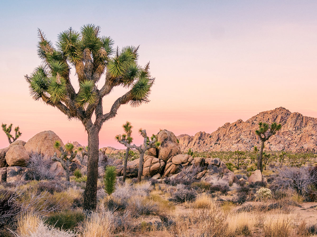
California Adventure Bucket List / Joshua Tree
Find a Waterfall in the Mojave Desert
Place
Rattlesnake
Canyon, Joshua
Tree National Park
Season
Spring, after the winter rainfall and before the summer heat
Distance
3.5 hours by car
Bragging Rights
Enjoying your own private sound bath
Vibe
A playground for grownups
Good to Know
Be in good shape and wear shoes with traction
Rattlesnake Canyon is one of the few unmarked trails in Joshua Tree, which means the guide is your curiosity. Start at the trailhead near the Indian Cove picnic area and go forth as far as you can, taking it easy on sandy washes or pushing yourself to scramble over the granite boulders and through the slot canyons and crevices. The deeper into the park you go, the more natural wonders arise. If you’ve timed it right (on the heels of a good rainy season), follow the stream, which will lead you to pools and even waterfalls. Once there, lie down on the cold granite, soak in the sounds of trickling water, and let your mind drift into tranquility. Consider it your own personal sound bath. You deserve it. —SARAH PFLEDDERER
Park entrances, roads, parking lots and trails are open at Joshua Tree National Park. Visitor centers and group campsites are closed. Visit nps.gov for updates.
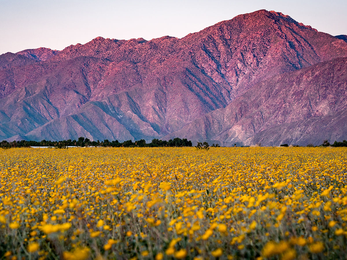
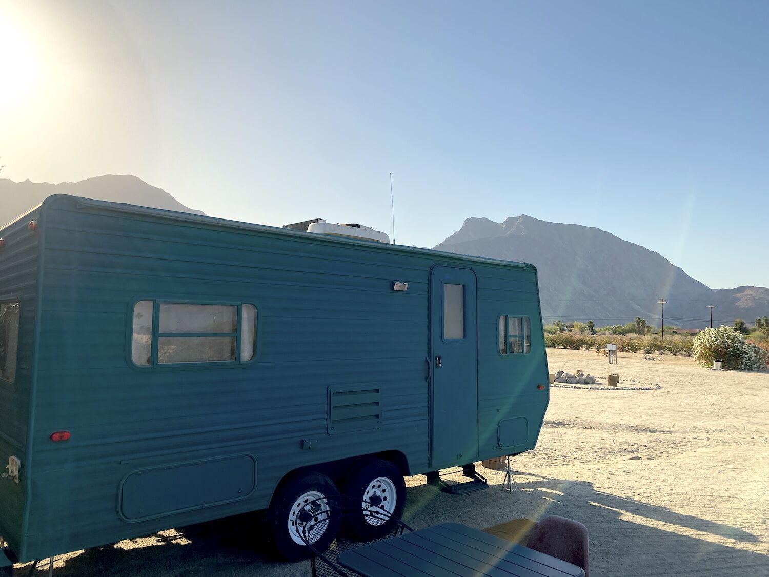
California Adventure Bucket List / Anza-Borrego
See the Desert in
Full Bloom
Place
Anza-Borrego Desert State Park
Season
Spring
Distance
Two hours by car
Bragging Rights
A camera roll full of cactus bloom
Vibe
Mars, but with gardens
Good to Know
Pick your weather window carefully
At its most inviting, the Colorado Desert (including Joshua Tree National Park and Anza-Borrego Desert State Park) is decorated with resplendent flowers. But do yourself a favor and skip wildflower mania; wait until later in the season, after the influencers have left, and the cholla, ocotillo, and beavertail cacti burst with luscious blooms. In Anza-Borrego, explore the seemingly extraterrestrial formations of the Wind Caves Trail, or squeeze through the Slot, a three-foot-wide canyon reminiscent of Utah’s canyonlands. The show really gets underway after dark. On clear nights, you’ll see why the area’s lack of light pollution makes it a renowned stargazing destination.
The park is now open until sunset, but parking is very limited. Campgrounds are still closed. Visit parks.ca.gov for updates.
Explore Endless Sand Dunes
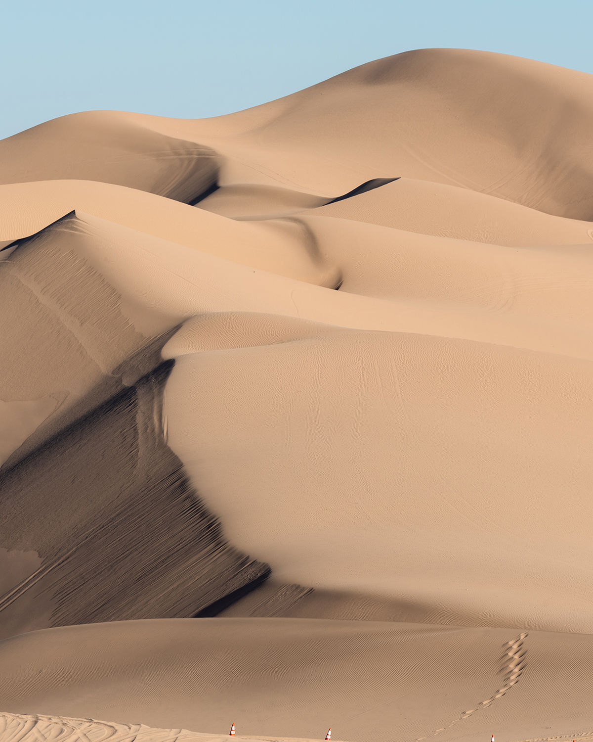
California Adventure Bucket List / Sand Dunes
Place
Imperial Sand Dunes Recreation Area
Season
Spring
Distance
2.5 hours by car
Bragging Rights
Your pictures will elicit responses like “Where is that?”
Vibe
Lawrence of Arabia, which was filmed here
Good to Know
The eastern side hosts finer sands, as seen in Return of the Jedi, also filmed here
Watching the breeze shape sand dunes is akin to observing geologic forces in real time, and you don’t have to fly to the Sahara to see some. The Algodones Dunes, in the southeast corner of California, are the state’s biggest. Sands from the ancient Lake Cahuilla form endless golden pyramids, some taller than 300 feet. Off-road enthusiasts are free to tear around in part of the 45-mile long wilderness. To appreciate this part of the Sonoran Desert under your own steam, visit the North Algodones Dunes Wilderness, north of highway 78, where ATVs are prohibited to allow the fragile and unique ecosystem to endure. Given the shape-shifting nature of the landscape, you’ll never visit the same place twice.
All campgrounds are closed. Visit blm.gov for updates.